Rorspitzli
#1853 among destinations in Switzerland

Facts and practical information
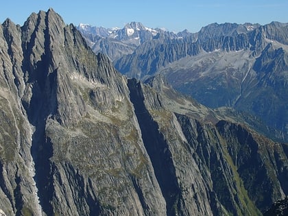
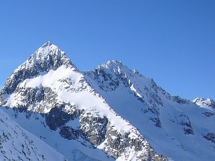
The Rorspitzli is a mountain of the Urner Alps, located west of Wassen and Göschenen in the canton of Uri. It lies on the range east of the Sustenjoch, culminating at the Fleckistock. ()
UriSwitzerland
Rorspitzli – popular in the area (distance from the attraction)
Nearby attractions include: Schöllenen Gorge, Steinsee, Sustenhorn, Salbitschijen.
 Nature, Natural attraction, Canyon
Schöllenen Gorge, Andermatt
112 min walk • Nestled in the heart of the Swiss Alps, the Schöllenen Gorge is a natural wonder that captivates travelers with its rugged beauty. Located near the mountain village of Andermatt, this dramatic gorge serves as a gateway to the Gotthard Pass, a historically significant...
 Nature, Natural attraction, Lake
Steinsee
124 min walk • Nestled in the serene landscapes of Switzerland, Steinsee is a picturesque lake that offers a tranquil retreat from the hustle and bustle of urban life. Known for its crystal-clear waters and the stunning mountainous backdrop, Steinsee is a hidden gem for nature...
 Scenic peak for camping, hiking and skiing
Sustenhorn
83 min walk • The Sustenhorn is a 3,502-metre-high mountain in the Uri Alps, located on the border between the cantons of Bern and Uri. It overlook Susten Pass from the south. Both sides of the massif are glaciated.
 Nature, Natural attraction, Mountain
Salbitschijen
20 min walk • The Salbitschijen is a mountain in the Urner Alps, overlooking Göschenen in the Swiss canton of Uri. It lies at the southern extremity of the range of the Fleckistock.
 Nature, Natural attraction, Lake
Göscheneralpsee
92 min walk • Göscheneralpsee is a reservoir in the municipality of Göschenen, Canton of Uri, Switzerland. The volume of the reservoir is 76 million cubic metres and its surface area 1.32 km².
 Nature, Natural attraction, Mountain
Gwächtenhorn
133 min walk • The Gwächtenhorn is a 3,420 metres high mountain in the Urner Alps, located on the border between the cantons of Bern and Uri. It overlooks the Stein Glacier and the Susten Pass on its north side and the Chelen Glacier on its south side.
 High Alpine pass with famed driving route
Susten Pass
113 min walk • Susten Pass is a mountain pass in the Swiss Alps. The pass road, built from 1938–1945, connects Innertkirchen in the canton of Bern with Wassen in the canton of Uri. A 300-metre long tunnel crosses the pass at 2,224 metres.
 Nature, Natural attraction, Mountain
Fleckistock
43 min walk • The Fleckistock is a 3,417 metres high mountain in the Urner Alps, overlooking Wassen in the canton of Uri. It is the highest summit of the group lying east of the pass of Sustenjoch.
 Nature, Natural attraction, Natural feature
Stein Glacier
115 min walk • The Stein Glacier is a 4 km long glacier situated in the Urner Alps in the canton of Berne in Switzerland. In 1973 it had an area of 6.06 km².
 Nature, Natural attraction, Mountain
Stucklistock
64 min walk • The Stucklistock is a mountain in the Urner Alps, overlooking the valley of Meiental in the canton of Uri. It lies only a few kilometres south-east of Susten Pass.
 Nature, Natural attraction, Mountain
Rienzenstock
137 min walk • The Rienzenstock is a mountain in Switzerland of the Glarus Alps, overlooking the valley of the Reuss near Göschenen in the canton of Uri. It is the culminating point of the group lying west of the Fellilücke.