Grauhorn
#1531 among destinations in Switzerland
Facts and practical information
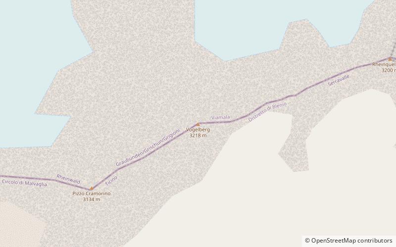
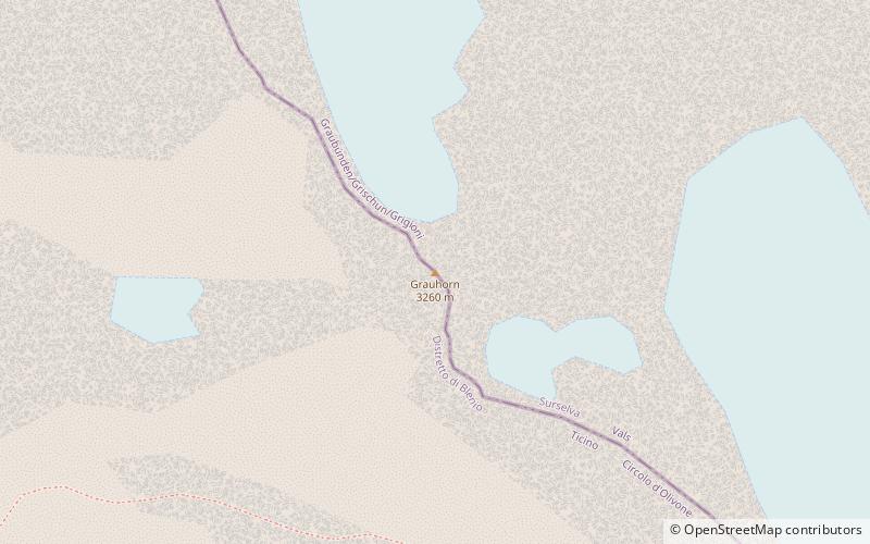
The Grauhorn is a mountain of the Lepontine Alps, located on the border between the Swiss cantons of Ticino and Graubünden. It lies north of the Rheinwaldhorn, on the range between the Val Carassino and the Länta valley. ()
TicinoSwitzerland
Grauhorn – popular in the area (distance from the attraction)
Nearby attractions include: Rheinwaldhorn, Lago di Luzzone, Sosto, Cima Rossa.
1 miSERidged alp summit first climbed in 1789Rheinwaldhorn
25 min walk • The Rheinwaldhorn is the highest point in the Swiss canton of Ticino at 3,402 metres above sea level. It lies on the border between the cantons of Graubünden and Ticino, in the Adula massif, part of the St.
5 miNWNature, Natural attraction, LakeLago di Luzzone
127 min walk • Lago di Luzzone is a reservoir in Ticino, Switzerland. The reservoir has a volume of 108 million m³ and a surface area of 1.27 km². It is located in the upper Blenio valley, in the municipalities of Ghirone and Aquila. The reservoir lies at a height of 1,606 metres above sea...
4.7 miNWNature, Natural attraction, MountainSosto
120 min walk • The Sosto is a mountain of the Swiss Lepontine Alps, overlooking Olivone in the canton of Ticino. It lies south of the lake of Luzzone and west of the Torrone di Nav.
5.1 miSENature, Natural attraction, MountainCima Rossa
129 min walk • Cima Rossa is a 3,161 metres high mountain in the Lepontine Alps, located on the border between the cantons of Ticino and Graubünden. On the west side it overlooks the valley of Malvaglia and on the east side it overlooks the valley of Calanca.
2.5 miSENature, Natural attraction, MountainVogelberg
65 min walk • The Vogelberg is a 3,218 metres high mountain of the Lepontine Alps, located on the border between the Swiss cantons of Ticino and Graubünden. It is the highest summit of the Lepontine Alps south of the Rheinwaldhorn.
2.9 miSWNature, Natural attraction, MountainCima di Gana Bianca
74 min walk • The Cima di Gana Bianca is a mountain of the Swiss Lepontine Alps, overlooking Acquarossa in the canton of Ticino. It lies west of the Rheinwaldhorn, between the main Blenio valley and the Val Malvaglia.
3.6 miSENature, Natural attraction, MountainPuntone dei Fraciòn
92 min walk • Puntone dei Fraciòn is a 3,202-metre-high mountain in the Lepontine Alps, located on the border between the Swiss cantons of Ticino and Graubünden. It is the highest peak of the Calanca valley. On its west side it overlooks the valley of Malvaglia. It lies approximately halfway between the Vogelberg and the Zapporthorn.
1.7 miENature, Natural attraction, MountainGüferhorn
45 min walk • The Güferhorn is a mountain in the Lepontine Alps, located between the valleys of Vals and Hinterrhein in Graubünden. At 3,379 metres above sea level it is the highest summit of the Lepontine Alps lying east of the Rheinwaldhorn.
4.4 miSENature, Natural attraction, MountainZapporthorn
113 min walk • The Zapporthorn or Pizzo Zapport is a mountain of the Swiss Lepontine Alps, overlooking San Bernardino Pass in Graubünden. Its summit is the tripoint between the valleys of Hinterrhein, Calanca and Mesolcina.
1.7 miNNature, Natural attraction, MountainPizzo di Cassimoi
44 min walk • Pizzo di Cassimoi is a mountain of the Lepontine Alps, located on the border between the Swiss cantons of Ticino and Graubünden. The mountain overlooks two lakes: Lago di Luzzone on its north-eastern side and Zervreilasee on its north-eastern side.
3.5 miNENature, Natural attraction, MountainZervreilahorn
90 min walk • The Zervreilahorn is a mountain of the Swiss Lepontine Alps, located south of Vals in the canton of Graubünden. The mountain overlooks the Zervreilasee on the north.