Zanaihorn
#1918 among destinations in Switzerland

Facts and practical information
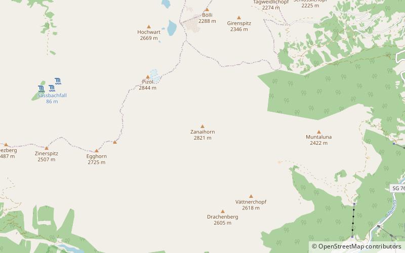
The Zanaihorn is a mountain of the Glarus Alps, located north of Vättis in the canton of St. Gallen. It lies on the range east of the Pizol, between the valleys of the Zanaibach and the Tersolbach. ()
Sankt GallenSwitzerland
Zanaihorn – popular in the area (distance from the attraction)
Nearby attractions include: Bad Ragaz, Alt-Haldenstein Castle, Calanda Mountain, Freudenberg Castle.
 Winter sport, Ski area
Bad Ragaz
150 min walk • Nestled in the heart of the Swiss Alps, Bad Ragaz is a serene ski area renowned for its breathtaking scenery and world-class winter sports facilities. This idyllic resort town, situated in the St. Gallen canton, offers a blend of luxury and adventure for skiers...
 Forts and castles
Alt-Haldenstein Castle
185 min walk • Alt-Haldenstein Castle is a castle in the municipality of Haldenstein of the Canton of Graubünden in Switzerland. It is a Swiss heritage site of national significance.
 Nature, Natural attraction, Mountain
Calanda Mountain
113 min walk • The Calanda is a mountain in the Glarus Alps with two main peaks: Haldensteiner Calanda and Felsberger Calanda, both located on the border between the cantons of St. Gallen and Graubünden in eastern Switzerland. It looms over Chur, the capital city of Graubünden.
 Forts and castles
Freudenberg Castle
151 min walk • Freudenberg Castle is a castle in the municipality of Bad Ragaz of the Canton of St. Gallen in Switzerland. It is a Swiss heritage site of national significance.
 Nature, Natural attraction, Lake
Gigerwaldsee
68 min walk • Gigerwaldsee is a reservoir in the municipality of Pfäfers, in the Canton of St. Gallen, Switzerland. The reservoir has a volume of 35.6 million m³ and a surface area of 71 ha. The arch dam Gigerwald was completed in 1976. It has a height of 147 m.
 Nature, Natural attraction, Lake
Stausee Mapragg
89 min walk • Stausee Mapragg is located at Pfäfers in the Canton of St. Gallen, Switzerland. Its surface area is 26 ha. The reservoir and Gigerwaldsee are operated by Kraftwerke Sarganserwald for pumped-storage hydroelectricity.
 Nature, Natural attraction, Mountain
Pizol
31 min walk • The Pizol is a mountain in the Glarus Alps of northeastern Switzerland, overlooking Wangs in the canton of St. Gallen. At 2,844 metres above sea level, it is the highest summit of the chain separating the valleys of the Seez and the Tamina rivers, and the highest mountain lying entirely within the canton of St.
 Nature, Natural attraction, Mountain
Ringelspitz
115 min walk • The Ringelspitz is a mountain of the Glarus Alps, located on the border between the Swiss cantons of St. Gallen and Graubünden. Reaching a height of 3,248 metres above sea level, it is the highest summit in the canton of St. Gallen. It is split between three municipalities: Pfäfers, Trin and Tamins.
 Nature, Natural attraction, Lake
Schwarzsee
66 min walk • Schwarzsee is a mountain lake at an elevation of 2368 m on the Pizol mountain of the Glarus Alps.
 Forts and castles
Wartenstein Castle
151 min walk • Wartenstein Castle is a castle in the municipality of Pfäfers of the Canton of St. Gallen in Switzerland. It is a Swiss heritage site of national significance.
 Forts and castles
Grottenstein Castle
181 min walk • Grottenstein Castle is a ruined castle in the municipality of Haldenstein of the Canton of Graubünden in Switzerland.