Gamsberg
#946 among destinations in Switzerland
Facts and practical information
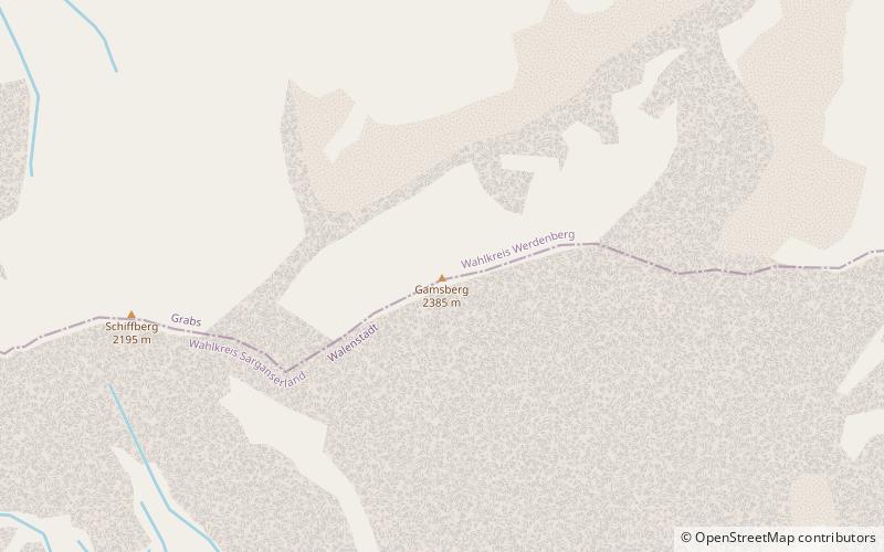
The Gamsberg is a mountain in the Appenzell Alps, overlooking the region of Walenstadt in the canton of St. Gallen. Located in the Alvier group it is the culminating point of the range lying between Lake Walenstadt and Toggenburg. ()
Sankt GallenSwitzerland
Gamsberg – popular in the area (distance from the attraction)
Nearby attractions include: Flums, Werdenbergersee, Chäserrugg, Schwendisee.
4.1 miSWWinter sport, Ski areaFlums
104 min walk • Nestled in the heart of the Swiss Alps, Flums is a picturesque destination that beckons outdoor enthusiasts and winter sports aficionados alike. Renowned for its ski area, this charming town offers a serene escape with slopes that cater to both novice and experienced...
4.8 miNENatural attraction, Body of water, ParkWerdenbergersee, Buchs
122 min walk • Werdenbergersee is a small lake in Buchs, below the town of Werdenberg, in the municipality of Grabs, Canton of St. Gallen, Switzerland.
3.2 miNWNature, Natural attraction, MountainChäserrugg
81 min walk • Nestled in the heart of the Swiss Alps, Chäserrugg is a mountain peak that offers breathtaking views and a serene escape from the hustle and bustle of daily life. At an elevation of 2,262 meters, it is the easternmost peak of the seven summits of the Churfirsten...
4.1 miNWNature, Natural attraction, LakeSchwendisee
105 min walk • Nestled in the picturesque landscape of Eastern Switzerland, Schwendisee is a serene mountain lake that epitomizes the tranquil beauty of the Swiss Toggenburg region. This hidden gem, less frequented by the tourist crowds, offers a peaceful retreat amidst nature's...
1.4 miNNature, Natural attraction, LakeVoralpsee
37 min walk • Voralpsee is a lake above Grabs in the Canton of St. Gallen, Switzerland.
2.6 miSENature, Natural attraction, MountainAlvier Mountain
67 min walk • The Alvier is a mountain in the Appenzell Alps, located halfway between Lake Walenstadt and the Rhine in the canton of St. Gallen. It is one of the main summits of the chain separating the valleys of the river Seez and the Rhine. Although involving a long hike, the summit is easily accessible by trails from both sides.
3.5 miWNature, Natural attraction, MountainHinterrugg
89 min walk • The Hinterrugg is the highest peak of the Churfirsten group, located in the Appenzell Alps. It overlooks the town of Walenstadt and the lake in the canton of St. Gallen.
4.4 miWNature, Natural attraction, MountainZuestoll
111 min walk • The Zuestoll is one of the peaks of the Churfirsten group, located in the Appenzell Alps. It lies between the valley of Toggenburg and Lake Walenstadt in the canton of St. Gallen. The summit is easily accessible by a trail on the northern side.
4.7 miWNature, Natural attraction, MountainBrisi
120 min walk • The Brisi is a mountain of the Churfirsten group, located in the Appenzell Alps. It overlooks Lake Walenstadt in the canton of St. Gallen. The summit is easily accessible by trail but via the north side in Toggenburg only.
1.1 miENature, Natural attraction, MountainFulfirst
30 min walk • The Fulfirst is a mountain of the Appenzell Alps, located north of Flums in the canton of St. Gallen. It lies in the Alvier group, between the Walensee and the Rhine Valley. The Fulfirst has two summits: the Gross Fulfirst and the Chli Fulfirst.
3.3 miSENature, Natural attraction, MountainGauschla
84 min walk • The Gauschla is a mountain of the Appenzell Alps, located north of Sargans in the canton of St. Gallen, Switzerland. It lies near the southern end of the range between the Walensee and the Rhine Valley, and one kilometre south-east of the Alvier.