Wildgärst
#1084 among destinations in Switzerland

Facts and practical information
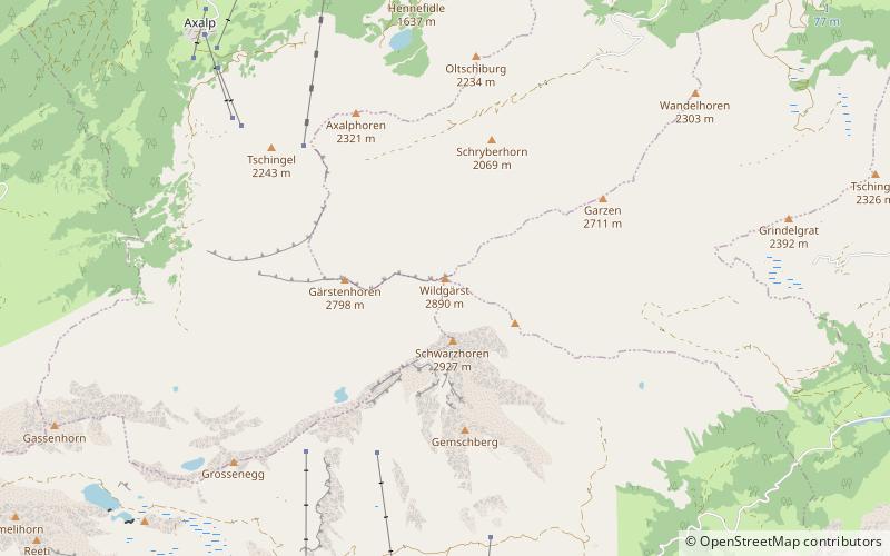
The Wildgärst is a mountain of the Bernese Alps, overlooking Lake Brienz in the Bernese Oberland. It lies north of the Schwarzhorn, on the range between Lake Brienz and the Grosse Scheidegg. ()
BernSwitzerland
Wildgärst plan & book
Unleash the traveler in you — discover the cheapest flight deals, find the perfect hotel or hostel nearby, and search for the best car rental prices. Travel at your own pace to discover new places and enjoy your journey.
Wildgärst – popular in the area (distance from the attraction)
Nearby attractions include: Bachalpsee, Ballenberg, First, Faulhorn.
 Scenic mountain lake with hiking trails
Bachalpsee, Grindelwald
76 min walk • Nestled in the heart of the Swiss Alps, the Bachalpsee is a serene alpine lake that epitomizes the idyllic beauty of Grindelwald, Switzerland. This tranquil body of water is situated at an elevation of 2,265 meters above sea level and offers a peaceful retreat for...
 Village-style living history museum
Ballenberg, Brienz
100 min walk • Ballenberg is an open-air museum in Switzerland that displays traditional buildings and architecture from all over the country. Located near Brienz in the municipality of Hofstetten bei Brienz, Canton of Bern, Ballenberg has over 100 original buildings that have been transported from their original sites.
 Summit with cable cars and dramatic views
First, Grindelwald
63 min walk • First is a mountain location and minor summit on the slopes of the Schwarzhorn in the Bernese Oberland. It is mostly known as a cable car station above Grindelwald and as a popular hiking area with the Bachalpsee in proximity.
 Natural attraction, Mountain, Park
Faulhorn, Grindelwald
96 min walk • The Faulhorn is a mountain of the Bernese Alps, located between Lake Brienz and Grindelwald in the Bernese Oberland. The summit is 2,681 metres high and can be reached by several trails.
 Nature, Natural attraction, Mountain
Wetterhorn, Grindelwald
107 min walk • The Wetterhorn is a peak in the Swiss Alps towering above the village of Grindelwald. Formerly known as Hasle Jungfrau, it is one of three summits on a mountain named the "Wetterhörner", the highest of which is the Mittelhorn and the lowest and most distant the Rosenhorn.
 Nature, Natural attraction, Lake
Hinterburgsee
46 min walk • Hinterburgsee is a lake in the Canton of Berne, Switzerland. Its surface area is 5 ha.
 Mountain with hiking and panoramic views
Schwarzhorn
12 min walk • The Schwarzhorn is a mountain of the Bernese Alps, located between Brienz and Grindelwald in the Bernese Oberland. With a height of 2,928 metres above sea level, it is the highest summit of the group north of the Grosse Scheidegg Pass.
 Nature, Natural attraction, Mountain
Reeti
91 min walk • The Reeti is a mountain of the Bernese Alps, overlooking Grindelwald in the Bernese Oberland. From the Bachalpsee, a trail leads to the summit.
 Nature, Natural attraction, Mountain
Mittelhorn
119 min walk • The Mittelhorn is a peak in the Swiss Alps close to the village of Grindelwald. It is the highest of the three composing the Wetterhorner massif.
 Alpine hut, Hiking
Gleckstein Hut
123 min walk • The Gleckstein Hut is a mountain hut of the Swiss Alpine Club, located east of Grindelwald in the canton of Bern. The hut lies at a height of 2,317 metres above sea level, above the Upper Grindelwald Glacier, at the foot of the Wetterhorn in the Bernese Alps.
 Nature, Natural attraction, Mountain
Tschingel
83 min walk • The Tschingel is a mountain of the Bernese Alps, overlooking Meiringen in the Bernese Oberland. It constitutes the eastern end of the Grindelgrat, a ridge descending from the Garzen summit. The summit is on the border between Meiringen and Schattenhalb municipalities.


