Capanna Cadlimo
#2605 among destinations in Switzerland

Facts and practical information
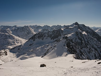
The Cadlimo Hut is a mountain hut of the Swiss Alpine Club in the canton of Ticino in Switzerland.
Capanna Cadlimo plan & book
Unleash the traveler in you — discover the cheapest flight deals, find the perfect hotel or hostel nearby, and search for the best car rental prices. Travel at your own pace to discover new places and enjoy your journey.
Capanna Cadlimo – popular in the area (distance from the attraction)
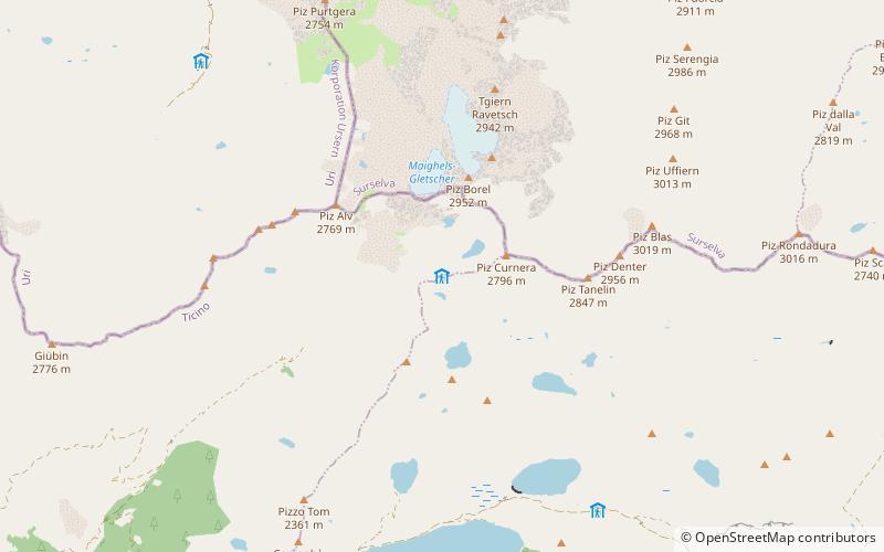
Nearby attractions include: Tomasee, Lago di Tom, Lake Cadagno, Lago Ritom.
 Mountain lake and source of the Rhine
Tomasee
111 min walk • Nestled in the serene alpine scenery of Switzerland lies the tranquil Tomasee, a lake that is often referred to as the source of the Rhine River. This pristine body of water, also known by its Romansh name Lai da Tuma, sits at an elevation of 2,345 meters above sea...
 Nature, Natural attraction, Lake
Lago di Tom
39 min walk • Lago di Tom is a lake in the Piora Valley, in the canton of Ticino, Switzerland. Its surface area is 13 ha.
 Nature, Natural attraction, Lake
Lake Cadagno
43 min walk • Lake Cadagno is a meromictic lake in the Piora valley, Switzerland. As one of a few meromictic lakes in Europe, it is the object of numerous scientific studies.
 Nature, Natural attraction, Lake
Lago Ritom
56 min walk • Lago Ritom is a lake in the Piora valley, Ticino, Switzerland. The natural lake is used as a reservoir by the Swiss Federal Railways to generate hydro-electric power for the Gotthard line.
 Nature, Natural attraction, Lake
Lago della Sella
117 min walk • Lago della Sella is a reservoir near St. Gotthard Pass in the canton of Ticino, Switzerland. The gravity dam with a height of 36 m was completed in 1947. The dam was planned and built under control of the Swiss engineer Fritz Gigax.

 Nature, Natural attraction, Mountain
Piz Badus
98 min walk • Piz Badus or Six Madun is a mountain in the Lepontine Alps, lying on the border between the cantons of Uri and Graubünden. In its northwestern face, which is the Graubünden side, lies Tomasee, source of the Anterior Rhine.
 Nature, Natural attraction, Mountain
Pizzo Centrale
98 min walk • Pizzo Centrale is a mountain in the Lepontine Alps, located on the border between the cantons of Uri and Ticino. At 2,999 metres above sea level, it is the highest summit overlooking Gotthard Pass from the east.
 Nature, Natural attraction, Mountain
Pizzo dell'Uomo
110 min walk • Pizzo dell'Uomo is a mountain of the Lepontine Alps and part of the extended Saint-Gotthard Massif, located between Lai da Sontga Maria and Pizzo del Sole, in the canton of Ticino, just southwest of the Passo del Lucomagno.
 Nature, Natural attraction, Mountain
Piz Ravetsch
25 min walk • Piz Ravetsch is a mountain in the Lepontine Alps, located in Graubünden near the border with Ticino. Piz Ravetsch is the highest summit of the range that separates Val Maighels and the valley of Lake Curnera.
 Nature, Natural attraction, Mountain
Piz Blas
41 min walk • Piz Blas is a mountain in the Lepontine Alps, located on the border between the cantons of Graubünden and Ticino. At 3,019 metres above sea level, Piz Blas is the highest mountain of Val Cadlimo, a valley drained by the Reno da Medel, a tributary of the Rhine.


