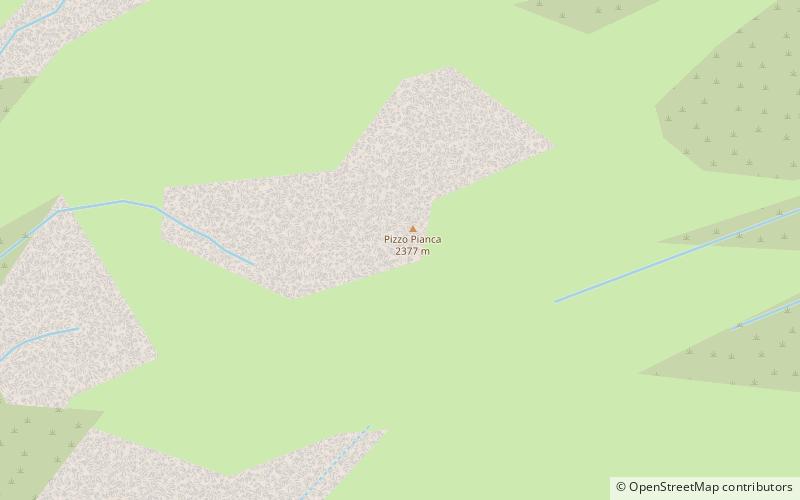
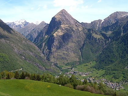
Pizzo Pianca
#1150 among destinations in Switzerland

Facts and practical information
Pizzo Pianca is a mountain of the Swiss Lepontine Alps, located north of Olivone in the canton of Ticino. On its southern side it overlooks the lake of Luzzone. ()
TicinoSwitzerland
Pizzo Pianca plan & book
Unleash the traveler in you — discover the cheapest flight deals, find the perfect hotel or hostel nearby, and search for the best car rental prices. Travel at your own pace to discover new places and enjoy your journey.
Pizzo Pianca – popular in the area (distance from the attraction)
Nearby attractions include: Lago Retico, Lago di Luzzone, Piz Terri, Sosto.
 Nature, Natural attraction, Lake
Lago Retico
86 min walk • Lago Retico is a lake in the canton Ticino, Switzerland. Its surface area is 8.5 ha.
 Nature, Natural attraction, Lake
Lago di Luzzone
24 min walk • Lago di Luzzone is a reservoir in Ticino, Switzerland. The reservoir has a volume of 108 million m³ and a surface area of 1.27 km². It is located in the upper Blenio valley, in the municipalities of Ghirone and Aquila. The reservoir lies at a height of 1,606 metres above sea...
 Nature, Natural attraction, Mountain
Piz Terri
97 min walk • Piz Terri is a mountain in the Lepontine Alps, located on the border between the cantons of Ticino and Graubünden. At 3,149 metres above sea level it is the highest summit lying on the chain between Greina and Soreda Pass.
 Nature, Natural attraction, Mountain
Sosto
52 min walk • The Sosto is a mountain of the Swiss Lepontine Alps, overlooking Olivone in the canton of Ticino. It lies south of the lake of Luzzone and west of the Torrone di Nav.
 Nature, Natural attraction, Mountain
Piz Vial
99 min walk • Piz Vial is a 3,168 metres high mountain of the Swiss Lepontine Alps, located south of Sumvitg in the canton of Graubünden. The summit, located one kilometres east of the canton of Ticino border, overlooks, together with its highest neighbour Piz Medel, the plateau of the Greina.
 Nature, Natural attraction, Mountain
Piz Medel
97 min walk • Piz Medel is a mountain in the Lepontine Alps, located on the border between the cantons of Ticino and Graubünden. At 3,210 metres above sea level it is the highest summit on the chain between Lukmanier Pass and Crap la Crusch.
 Nature, Natural attraction, Mountain
Pizzo di Cassimoi
108 min walk • Pizzo di Cassimoi is a mountain of the Lepontine Alps, located on the border between the Swiss cantons of Ticino and Graubünden. The mountain overlooks two lakes: Lago di Luzzone on its north-eastern side and Zervreilasee on its north-eastern side.
 Nature, Natural attraction, Mountain
Zervreilahorn
128 min walk • The Zervreilahorn is a mountain of the Swiss Lepontine Alps, located south of Vals in the canton of Graubünden. The mountain overlooks the Zervreilasee on the north.
 Nature, Natural attraction, Mountain
Furggeltihorn
145 min walk • The Furggeltihorn is a mountain of the Lepontine Alps, overlooking the Zervreilasee in the canton of Graubünden.
 Nature, Natural attraction, Mountain
Plattenberg
81 min walk • The Plattenberg is a mountain of the Lepontine Alps, located on the border between the Swiss cantons of Ticino and Graubünden. It lies approximately halfway between the lakes of Luzzone and Zervreila.
 Nature, Natural attraction, Mountain
Torrone di Nav
64 min walk • The Torrone di Nav is a mountain of the Swiss Lepontine Alps, located east of Olivone in the canton of Ticino. On its northern side it overlooks the lake of Luzzone.


