Rosablanche
#465 among destinations in Switzerland
![Rosablanche location map](https://tzmedia.b-cdn.net/media/images/static-maps/ch/46_0605_7_35417.jpg)
Facts and practical information
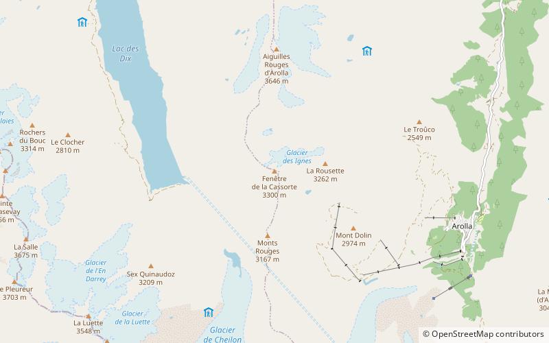
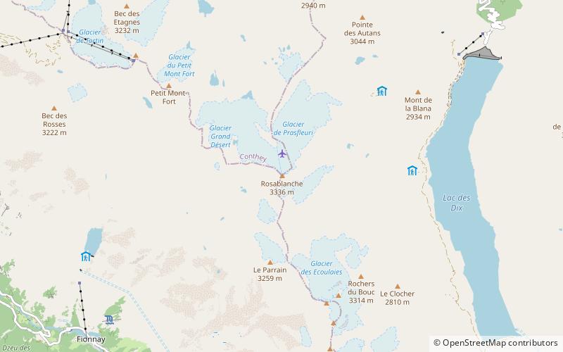
The Rosablanche is a mountain of the Swiss Pennine Alps, overlooking the Lac des Dix in the canton of Valais. It lies on the range between the valleys of Bagnes and Hérémence, north of Le Pleureur. ()
ValaisSwitzerland
Rosablanche plan & book
Unleash the traveler in you — discover the cheapest flight deals, find the perfect hotel or hostel nearby, and search for the best car rental prices. Travel at your own pace to discover new places and enjoy your journey.
Rosablanche – popular in the area (distance from the attraction)
Nearby attractions include: Lac de Cleuson, Lac de Louvie, Grande Dixence Dam, Mont Gelé.
3.6 miNWNature, Natural attraction, LakeLac de Cleuson
92 min walk • Lac de Cleuson is a reservoir in the municipality of Nendaz, Valais, Switzerland. Its surface area is 0.51 km². Water from the reservoir is often pumped into the Grande Dixence Dam's reservoir, Lac des Dix, for use in hydroelectricity production.
2.3 miWNature, Natural attraction, LakeLac de Louvie
58 min walk • Lac de Louvie is a lake above Fionnay in the canton of Valais, Switzerland. The Lac de Louvie is paradise for all nature lovers such as trail runners and hikers. It is Situated at 2,213 metres above sea level and it’s a 2 hour walk from Fionnay.
2.7 miNEDam, BridgeGrande Dixence Dam
70 min walk • The Grande Dixence Dam is a concrete gravity dam on the Dixence at the head of the Val d'Hérémence in the canton of Valais in Switzerland. At 285 m high, it is the tallest gravity dam in the world, fifth tallest dam overall, and the tallest dam in Europe. It is part of the Cleuson-Dixence Complex.
4.6 miNWNature, Natural attraction, MountainMont Gelé, Verbier
119 min walk • Mont Gelé is a mountain of the Pennine Alps, part of the Municipality Riddes and overlooking Verbier in the Swiss canton of Valais. Located on the range north of Mont Fort, its summit is the tripoint between the municipalities of Bagnes, Riddes and Nendaz.
2.6 miNWNature, Natural attraction, MountainMont Fort
67 min walk • Mont Fort is a mountain of the Pennine Alps, located near Verbier in the Swiss canton of Valais. It lies on the range between the valleys of Bagnes and Nendaz, north of the Rosablanche.
2.2 miNWNature, Natural attraction, LakeLac du Grand Désert
56 min walk • Lac du Grand Désert is a lake in the canton of Valais, Switzerland. It is located at an elevation of 2642 m, fed by the Grand Désert Glacier.
3.8 miSENature, Natural attraction, MountainLa Luette
98 min walk • La Luette is a mountain of the Pennine Alps, located between the valleys of Bagnes and Hérens in the canton of Valais. It lies just south of Le Pleureur.
2.8 miWNature, Natural attraction, MountainBec des Rosses
71 min walk • The Bec des Rosses is a mountain of the Pennine Alps, overlooking Verbier in the Swiss canton of Valais. It is connected to Verbier and the 4 Vallees ski area.
3.5 miENature, Natural attraction, MountainPointe de Vouasson
90 min walk • The Pointe de Vouasson is a mountain of the Swiss Pennine Alps, overlooking Lac des Dix in the canton of Valais. It lies between the valleys of Hérémence and Arolla, north of the Aiguilles Rouges d'Arolla.
4.9 miSNature, Natural attraction, MountainGrand Tavé
126 min walk • The Grand Tavé is a mountain of the Swiss Pennine Alps, located south of Fionnay in the canton of Valais. It belongs to the Grand Combin massif and lies east of the Corbassière Glacier.
4.2 miSENature, Natural attraction, MountainLa Cassorte
108 min walk • La Cassorte is a mountain of the Swiss Pennine Alps, located west of Arolla in the canton of Valais. It lies on the range between the Lac des Dix and the Val d'Arolla, south of the Aiguilles Rouges d'Arolla.