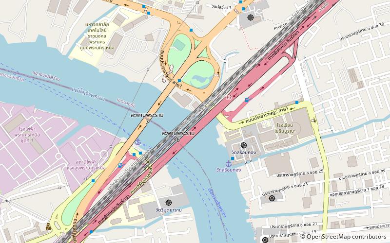
Rama VI Bridge, Bangkok
Map

Map

Facts and practical information
Rama VI Bridge is a railway bridge over the Chao Phraya River in Bangkok, in Thailand, connecting the districts Bang Sue and Bang Phlat. It is the first bridge to cross the Chao Phraya River and was initially both a single-track railway and road bridge. Construction started in December 1922, during the reign of Vajiravudh to link the Northern Line with the Southern Line. Construction cost was 2,714,113.30 baht and It was officially opened on 1 January 1927. ()
Day trips
Rama VI Bridge – popular in the area (distance from the attraction)
Nearby attractions include: Wat Soi Thong, Rama VII Bridge, Bang Sue District, Kiakkai.
Frequently Asked Questions (FAQ)
Which popular attractions are close to Rama VI Bridge?
Nearby attractions include Rama VII Bridge, Bangkok (4 min walk), Wat Soi Thong, Bangkok (5 min walk).
How to get to Rama VI Bridge by public transport?
The nearest stations to Rama VI Bridge:
Ferry
Bus
Metro
Ferry
- Rama 7 Bridge • Lines: เรือด่วนพิเศษธงส้ม, เรือด่วนพิเศษธงเขียว, เรือด่วนพิเศษธงเหลือง, เรือประจำทาง (ไม่มีธง) (5 min walk)
- Bang Po • Lines: เรือด่วนพิเศษธงส้ม, เรือด่วนพิเศษธงเหลือง, เรือประจำทาง (ไม่มีธง) (15 min walk)
Bus
- Opposite Rama 7 Bridge Pier • Lines: 1010 มจพ. → สี่แยกบางสีทอง (6 min walk)
- Opposite King Mongkut's University of Technology North Bangkok • Lines: 1010 (9 min walk)
Metro
- Bang Pho • Lines: MRT Blue (16 min walk)
- Bang O • Lines: MRT Blue (29 min walk)


