Wat Soi Thong, Bangkok

Gallery (1)
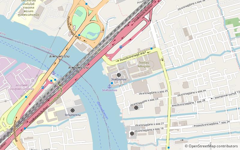
Map
Map
Facts and practical information
Wat Soi Thong is a third-classed royal Buddhist temple in Bangkok. The monastery located by Chao Phraya River near Rama VI Bridge, Rama VII Bridge and Yothinburana School. It was built around 1851, assuming that built by the descendants of Chao Phraya Si Phiphat during King Rama VI's reign. ()
Coordinates: 13°48'46"N, 100°31'6"E
Address
วิภาวดี (บางซื่อ)Bangkok
ContactAdd
Social media
Add
Getting there by public transportation
Public transportation stops near this location
- Metro
- Bus
- Train
- Ferry
 Metro
Metro
- Calculate routeRama 7 Bridge 9 min walk
- Calculate routeBang Po 12 min walk
- Calculate routeKiak Kai 25 min walk
- Calculate routeOpposite Rama 7 Bridge Pier 9 min walk
- Calculate routeOpposite King Mongkut's University of Technology North Bangkok 13 min walk
- Calculate routeKing Mongkut's University of Technology North Bangkok 13 min walk
- Calculate routeEgat 14 min walk
- Calculate routeBang Pho 13 min walk
- Calculate routeTao Poon 25 min walk
- Calculate routeBang Son 28 min walk
- Calculate routeBang O 29 min walk
- Calculate routeBang Son 32 min walk
Day trips


Frequently Asked Questions (FAQ)
Which popular attractions are close to Wat Soi Thong?
Nearby attractions include Rama VI Bridge, Bangkok (5 min walk), Rama VII Bridge, Bangkok (8 min walk), Bang Sue District, Bangkok (23 min walk).
How to get to Wat Soi Thong by public transport?
The nearest stations to Wat Soi Thong:
Ferry
Bus
Metro
Train
Ferry
- Rama 7 Bridge • Lines: เรือด่วนพิเศษธงส้ม, เรือด่วนพิเศษธงเขียว, เรือด่วนพิเศษธงเหลือง, เรือประจำทาง (ไม่มีธง) (9 min walk)
- Bang Po • Lines: เรือด่วนพิเศษธงส้ม, เรือด่วนพิเศษธงเหลือง, เรือประจำทาง (ไม่มีธง) (12 min walk)
Bus
- Opposite Rama 7 Bridge Pier • Lines: 1010 มจพ. → สี่แยกบางสีทอง (9 min walk)
- Opposite King Mongkut's University of Technology North Bangkok • Lines: 1010 (13 min walk)
Metro
- Bang Pho • Lines: MRT Blue (13 min walk)
- Tao Poon • Lines: MRT Blue, MRT Purple (25 min walk)
Train
- Bang Son (32 min walk)