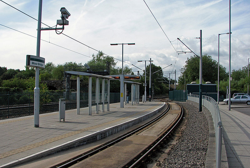
Moor Bridge tram stop, Nottingham

Gallery (2)
Map
Map
Gallery
Facts and practical information
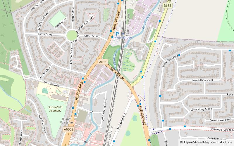
Moor Bridge is a tram stop on the Nottingham Express Transit light rail system in the city of Nottingham in the suburb of Bulwell. It is part of the NET's initial system, and is situated on the long single line section between Bulwell and Hucknall tram stops that runs alongside the Robin Hood railway line. Like all the other intermediate stops on this section, the stop has a passing loop with an island platform situated between the two tracks of the loop. ()
Opened: 2004 (22 years ago)Coordinates: 53°0'46"N, 1°11'15"W
Address
BulwellNottingham
ContactAdd
Social media
Add
Getting there by public transportation
Public transportation stops near this location
- Bus
- Tram
- Train
 Bus
Bus
- Calculate routeMoorbridge Ponds 2 min walk
- Calculate routeLawton Drive 3 min walk
- Calculate routeBestwood Road 4 min walk
- Calculate routeMoor Bridge 4 min walk
- Calculate routeBulwell Forest 13 min walk
- Calculate routeBulwell 26 min walk
- Calculate routeButler's Hill 29 min walk
- Calculate routeBulwell 26 min walk
Day trips


Frequently Asked Questions (FAQ)
Which popular attractions are close to Moor Bridge tram stop?
Nearby attractions include Leen Valley, Nottingham (14 min walk), Church of St John the Divine, Nottingham (21 min walk), Top Valley, Nottingham (22 min walk), Bulwell, Nottingham (24 min walk).
How to get to Moor Bridge tram stop by public transport?
The nearest stations to Moor Bridge tram stop:
Bus
Tram
Train
Bus
- Moorbridge Ponds • Lines: 141, 728 (2 min walk)
- Lawton Drive • Lines: 728, 79, L6 (3 min walk)
Tram
- Moor Bridge • Lines: 1 (4 min walk)
- Bulwell Forest • Lines: 1 (13 min walk)
Train
- Bulwell (26 min walk)