Garratts Wood, Exmoor National Park
#69 among attractions in Exmoor National Park

Facts and practical information
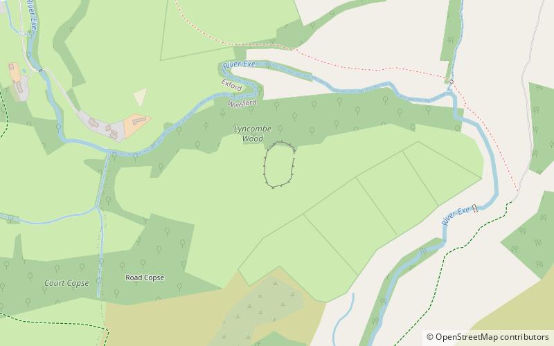
Garratts Wood is a woodland in Somerset, England, near the village of Winsford. It covers a total area of 1.11 hectares. It is owned and managed by the Woodland Trust. ()
Exmoor National Park United Kingdom
Garratts Wood – popular in the area (distance from the attraction)
Nearby attractions include: Luttrell Arms, Tarr Steps, Dunkery Hill, Brendon Hills.
 Nightlife
Luttrell Arms, Dunster
197 min walk • The Luttrell Arms in Dunster, Somerset, England was built in the late 15th century and is located in the centre of the medieval town of Dunster. The building has been designated as a Grade II* listed building since 22 May 1969. The original building has been enlarged over the years by addition of further wings. It is now used as a hotel.
 Ancient bridge made of stone slabs
Tarr Steps, Exmoor National Park
74 min walk • The Tarr Steps is a clapper bridge across the River Barle in the Exmoor National Park, Somerset, England. They are located in a national nature reserve about 2.5 miles south east of Withypool and 4 miles north west of Dulverton.
 Archaeological site
Dunkery Hill, Porlock
104 min walk • Dunkery Beacon at the summit of Dunkery Hill is the highest point on Exmoor and in Somerset, England. It is also the highest point in southern England outside of Dartmoor.
 Nature, Natural attraction, Hill
Brendon Hills, Exmoor National Park
81 min walk • The Brendon Hills are a range of hills in west Somerset, England. The hills merge level into the eastern side of Exmoor and are included within the Exmoor National Park.
 Memorial
Caratacus Stone, Exmoor National Park
33 min walk • The Caratacus Stone, sometimes known as the Caractacus Stone, is an inscribed stone on Exmoor in Somerset, England. It is thought to date from the 6th century, and it has been a scheduled monument since 1925.
 Forts and castles
Road Castle, Exmoor National Park
75 min walk • Road Castle is an Iron Age bank and ditch in the West Somerset district of Somerset, England. The hill fort is situated approximately 2 miles west from the village of Winsford.
 Archaeological site
Withypool Stone Circle, Exmoor National Park
101 min walk • Withypool Stone Circle, also known as Withypool Hill Stone Circle, is a stone circle located on the Exmoor moorland, near the village of Withypool in the southwestern English county of Somerset.
 Church
Church of St Giles, Exmoor National Park
98 min walk • The Anglican Church of St Giles in Hawkridge, Somerset, England was built in the 14th century. It is a Grade II* listed building.
 Church
Church of St Andrew, Exmoor National Park
91 min walk • The Anglican Church of St Andrew in Withypool, Somerset, England was built in late medieval period. It is a Grade II* listed building.
 Bridge
Withypool Bridge, Exmoor National Park
92 min walk • The Withypool Bridge is an arch bridge that carries a small road over the River Barle at Withypool in Somerset, England. It is a Grade II* listed building. The red sandstone bridge was built in the 19th century.
 Church
Church of St Mary Magdelene, Exmoor National Park
90 min walk • The Anglican Church of St Mary Magdelene in Exford, Somerset, England was built in the 15th century. It is a Grade II* listed building.