Stechford Baptist Church, Birmingham
Facts and practical information
Stechford Baptist Church is a small Baptist church in the Stechford area of Birmingham, England and is notable for a 40-year history of combating racism and promoting community cohesion in a British urban-deprived setting. In the vanguard of attempts from the 1960s to engage immigrant Caribbean communities within mainstream indigenous churches, it played a key role in opposing the National Front during the 1970s. By the 1980s and 1990s it achieved a 50%/50% balance of indigenous and non-indigenous membership and leadership, thereby contrasting sharply with a UK tendency towards majority-white and majority-black churches, where splits are typically in the 90/10 ratio. During the 1990s the church developed relationships with a number of black-led community groups which had grown out of the 1985 Handsworth riots, and from 2000 the church worked to support asylum-seeker rights. One of the church leaders, Mrs E C McGhie-Belgrave, was awarded the MBE in 2002 and subsequently the Queen's Golden Jubilee Award in 2004 for her contribution to community cohesion and Black-White issues in Birmingham. ()
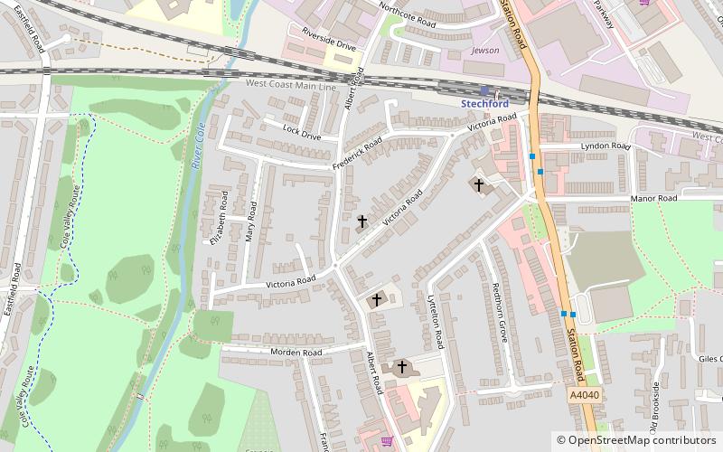
74 Victoria RdStechford and Yardley NorthBirmingham B33 8AH
- Train
 Train
Train
- Calculate routeStechford 5 min walk
- Calculate routeLea Hall 31 min walk


Frequently Asked Questions (FAQ)
Which popular attractions are close to Stechford Baptist Church?
How to get to Stechford Baptist Church by public transport?
Train
- Stechford (5 min walk)
- Lea Hall (31 min walk)