Birmingham EcoPark, Birmingham
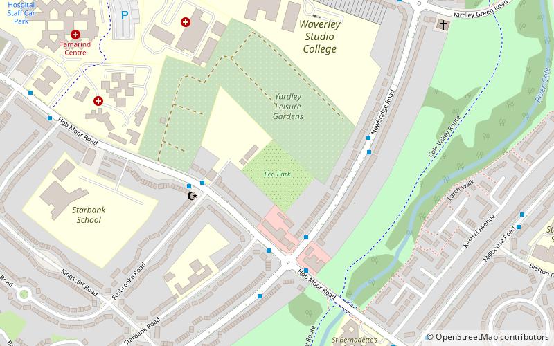
Map
Facts and practical information
The Birmingham EcoPark is an environmental education centre in the Small Heath area of Birmingham, England, operated by the Wildlife Trust for Birmingham and the Black Country. Each year thousands of visitors are inspired by the wildlife they encounter on their visits to the site. EcoPark offers opportunities for families, schools and local residents of all ages to get hands on with nature and discover the wonders of the natural world on their doorstep. ()
Coordinates: 52°28'20"N, 1°49'47"W
Address
Bordesley GreenBirmingham
ContactAdd
Social media
Add
Getting there by public transportation
Public transportation stops near this location
- Bus
- Train
 Bus
Bus
- Calculate routeCoventry Rd / Deakins Rd 17 min walk
- Calculate routeSk 22 min walk
- Calculate routeStechford 31 min walk
- Calculate routeAdderley Park 34 min walk
Day trips


Frequently Asked Questions (FAQ)
Which popular attractions are close to Birmingham EcoPark?
Nearby attractions include St Benedict's Church, Birmingham (13 min walk), St Paul's Church, Birmingham (15 min walk), St Cyprian's Church, Birmingham (21 min walk), St Gregory the Great's Church, Birmingham (22 min walk).
How to get to Birmingham EcoPark by public transport?
The nearest stations to Birmingham EcoPark:
Bus
Train
Bus
- Coventry Rd / Deakins Rd • Lines: X1, X2 (17 min walk)
- Sk • Lines: X1, X2 (22 min walk)
Train
- Stechford (31 min walk)
- Adderley Park (34 min walk)