Downs Link, Guildford

Gallery (1)
Map
Map
Facts and practical information
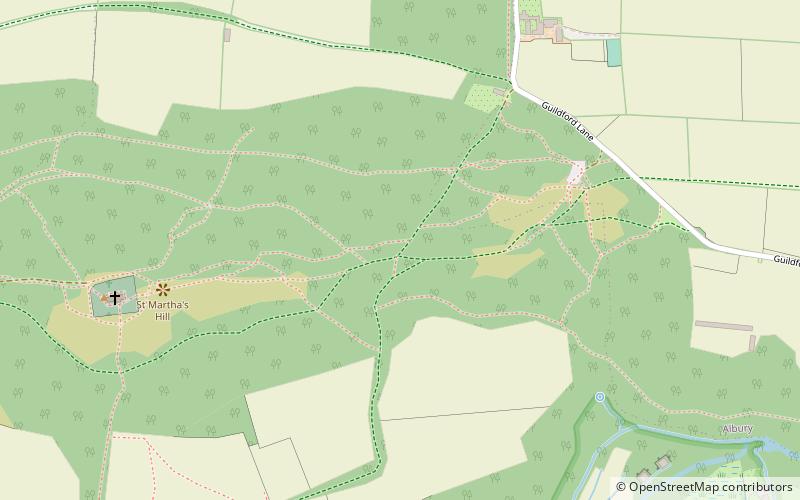
The Downs Link is a 36.7 miles footpath and bridleway linking the North Downs Way at St. Martha's Hill in Surrey with the South Downs Way near Steyning in West Sussex and on via the Coastal Link to Shoreham-by-Sea. ()
Length: 36.7 miCoordinates: 51°13'31"N, 0°31'23"W
Address
Tillingbourne (St. Martha)Guildford
ContactAdd
Social media
Add
Getting there by public transportation
Public transportation stops near this location
- Bus
- Train
 Bus
Bus
- Calculate routeSurrey Hills 16 min walk
- Calculate routeLockner Farm 17 min walk
- Calculate routeChilworth Railway Station 18 min walk
- Calculate routeBlacksmith Lane 21 min walk
- Calculate routeChilworth 19 min walk
Day trips


Frequently Asked Questions (FAQ)
Which popular attractions are close to Downs Link?
Nearby attractions include St Martha's Hill, Guildford (6 min walk), St Martha's Hill and Colyer's Hanger, Guildford (7 min walk), Chilworth Manor, Chilworth (12 min walk), Newlands Corner, Guildford (22 min walk).
How to get to Downs Link by public transport?
The nearest stations to Downs Link:
Bus
Train
Bus
- Surrey Hills • Lines: 32, 525 (16 min walk)
- Lockner Farm • Lines: 32, 525 (17 min walk)
Train
- Chilworth (19 min walk)