Myreside Cricket Ground, Edinburgh
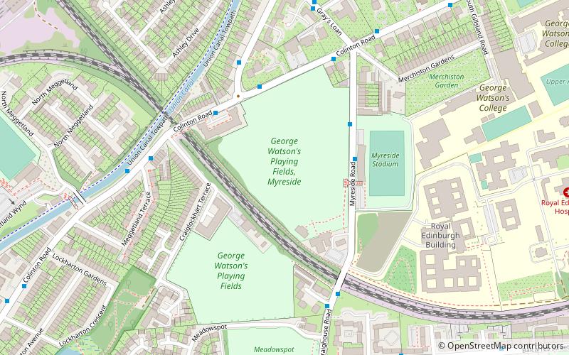
Map
Facts and practical information
Myreside Cricket Ground is a cricket ground in Edinburgh, Scotland. The first recorded match held on the ground came in 1901 when George Watson's College played Blair Lodge School. The ground held its first first-class match when Scotland played Ireland in 1982, while in 1990 it held a second first-class fixture between the sides. The ground held its first List A match when Scotland played Glamorgan in the 1985 NatWest Trophy. Five further List A matches were played there, the last of which saw Scotland play Worcestershire in the 1993 NatWest Trophy. ()
Coordinates: 55°55'39"N, 3°13'33"W
Getting there by public transportation
Public transportation stops near this location
- Bus
- Tram
- Train
 Bus
Bus
- Calculate routePolwarth Terrace 4 min walk
- Calculate routeMeggetland Terrace 5 min walk
- Calculate routeAshley Terrace 7 min walk
- Calculate routeSlateford 18 min walk
- Calculate routeMurrayfield Stadium 28 min walk
- Calculate routeBalgreen 32 min walk
Day trips


Frequently Asked Questions (FAQ)
Which popular attractions are close to Myreside Cricket Ground?
Nearby attractions include Shandon, Edinburgh (12 min walk), Little Free Library - Shandon, Edinburgh (12 min walk), Morningside Cemetery, Edinburgh (13 min walk), Slateford, Edinburgh (14 min walk).
How to get to Myreside Cricket Ground by public transport?
The nearest stations to Myreside Cricket Ground:
Bus
Train
Tram
Bus
- Polwarth Terrace • Lines: 10, 27 (4 min walk)
- Meggetland Terrace • Lines: 10, 27 (5 min walk)
Train
- Slateford (18 min walk)
Tram
- Murrayfield Stadium • Lines: Edinburgh Trams Eastbound, Edinburgh Trams Westbound (28 min walk)
- Balgreen • Lines: Edinburgh Trams Eastbound, Edinburgh Trams Westbound (32 min walk)