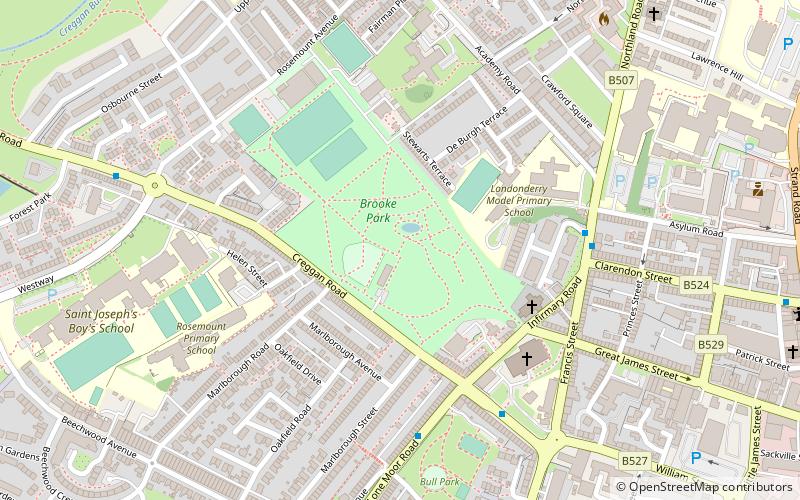
Brooke Park, Derry
Map
Facts and practical information
Brooke Park is a 3.88 acre Victorian park in the centre of Derry, Northern Ireland. The park contains many amenities, including a café, children's playground and football pitch, as well as a statue of Sir Robert Ferguson. After a period of decline and disrepair, the park was part of a £5.6 million restoration project and reopened in 2017. ()
Elevation: 144 ft a.s.l.Coordinates: 55°0'5"N, 7°19'52"W
Address
Rosemount AvenueDerry BT48 7HH
Contact
+44 28 7126 2637
Social media
Add
Getting there by public transportation
Public transportation stops near this location
- Bus
- Train
 Bus
Bus
- Calculate routeFoyle Bus Station 16 min walk
- Calculate routeAirporter HQ 29 min walk
- Calculate routeLondonderry 24 min walk
Day trips


Frequently Asked Questions (FAQ)
Which popular attractions are close to Brooke Park?
Nearby attractions include St Eugene's Cathedral, Derry (4 min walk), North West Regional College, Derry (7 min walk), Bogside, Derry (9 min walk), Museum of Free Derry, Derry (10 min walk).
How to get to Brooke Park by public transport?
The nearest stations to Brooke Park:
Bus
Train
Bus
- Foyle Bus Station (16 min walk)
- Airporter HQ (29 min walk)
Train
- Londonderry (24 min walk)