Primrose Hill Park, Coventry
Map
Facts and practical information
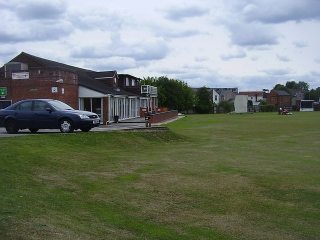
Primrose Hill Park is a public park in the Hillfields district of Coventry. ()
Elevation: 295 ft a.s.l.Coordinates: 52°24'46"N, 1°29'34"W
Address
10 Coronation RdNorth West Coventry (St. Michael's)Coventry CV1 5BX
ContactAdd
Social media
Getting there by public transportation
Public transportation stops near this location
- Bus
- Train
 Bus
Bus
- Calculate routeBerry St / Vauxhall St 2 min walk
- Calculate routePaynes Lane / Days Lane 4 min walk
- Calculate routeBritannia Street / Wren Street 5 min walk
- Calculate routeHarnall Lane East / Trentham Rd 5 min walk
- Calculate routeCoventry 31 min walk
Day trips


Frequently Asked Questions (FAQ)
When is Primrose Hill Park open?
Primrose Hill Park is open:
- Monday 24h
- Tuesday 24h
- Wednesday 24h
- Thursday 24h
- Friday 24h
- Saturday 24h
- Sunday 24h
Which popular attractions are close to Primrose Hill Park?
Nearby attractions include Gosford Park Children's Centre, Coventry (14 min walk), Coventry Central Baths, Coventry (15 min walk), Coventry University, Coventry (15 min walk), Gosford Street, Coventry (15 min walk).
How to get to Primrose Hill Park by public transport?
The nearest stations to Primrose Hill Park:
Bus
Train
Bus
- Berry St / Vauxhall St • Lines: 17, 17A (2 min walk)
- Paynes Lane / Days Lane • Lines: 17, 17A (4 min walk)
Train
- Coventry (31 min walk)