Foel Cwm Sian Llŵyd
#4538 among destinations in the United Kingdom
![Foel Cwm Sian Llŵyd location map](https://tzmedia.b-cdn.net/media/images/static-maps/gb/52_8705_-3_49315.jpg)
Facts and practical information
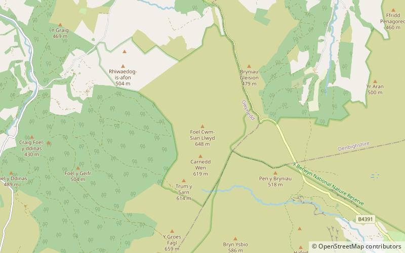
Foel Cwm Sian Llŵyd is a subsidiary summit of Cyrniau Nod in north east Wales. It forms a part of the Berwyn range known as the Hirnantau. Its summit has the Snowdonia National Park boundary running through it, and is the most easterly 2000 ft summit in the park. ()
WalesUnited Kingdom
Foel Cwm Sian Llŵyd – popular in the area (distance from the attraction)
Nearby attractions include: St Melangell's Church, Moel Sych, Craig Rhiwarth, Cyrniau Nod.
3.5 miSEChurchSt Melangell's Church
89 min walk • St Melangell's Church, Pennant Melangell is a small church located on a minor road which joins the B4391 near the village of Llangynog, Powys, Wales. It houses the restored shrine of Saint Melangell, reputed to be the oldest Romanesque shrine in Great Britain.
4.4 miENature, Natural attraction, MountainMoel Sych
112 min walk • Moel Sych with a height of 826.7 metres is a subsidiary summit of Cadair Berwyn in north east Wales. It is the third highest summit in the Berwyn range after Cadair Berwyn and Cadair Berwyn North Top.
4.5 miSENature, Natural attraction, CliffCraig Rhiwarth
116 min walk • Craig Rhiwarth is a mountain in the Berwyn range, in Powys, Wales, overlooking the village of Llangynog to the south. On the summit is an Iron Age hillfort, and there are remains of slate quarrying on the southern slopes.
4.3 miENature, Natural attraction, MountainCyrniau Nod
111 min walk • Cyrniau Nod is a mountain summit in north east Wales. It is a former Marilyn, the Marilyn summit now being the nearby Foel Cedig. Its summit has the Snowdonia National Park boundary running through it. A number of rivers and streams rise from near the mountain including Afon Tanat, Afon Cedig and Nant Ystrad-y-Groes.
4.7 miENature, Natural attraction, MountainTomle
120 min walk • Tomle is a top of Cadair Berwyn in north east Wales. It is the highest of the summits found on the most easterly of Cadair Berwyn's long south ridges. Tomle's summit is boggy and unmarked. To the north, the ridge continues up to Cadair Berwyn North Top. The Craig Berwyn face starting on the west side of the ridge.
4.7 miENature, Natural attraction, MountainFoel Wen South Top
120 min walk • Foel Wen South Top is a top of Foel Wen in north east Wales. It is one of the summits found on the most easterly of Cadair Berwyn's long south ridges. The summit is grassy, and unmarked. To the north lies Tomle, while to the south lies its Mynydd Tarw.
4.7 miENature, Natural attraction, MountainLlechwedd Du
120 min walk • Llechwedd Du is a subsidiary summit of Esgeiriau Gwynion in north Wales. It forms a long peat bog plateau that start at the end of Esgeiriau Gwynion's south ridge, and ends with the higher summit of Moel y Cerrig Duon.
4.7 miENature, Natural attraction, MountainCefn Gwyntog
120 min walk • Cefn Gwyntog is a top of Cyrniau Nod in north east Wales. It forms a part of the Berwyn range known as the Hirnantau. Its summit lies just outside the Snowdonia National Park.
4.7 miENature, Natural attraction, MountainMoel y Cerrig Duon
120 min walk • Moel y Cerrig Duon is a subsidiary summit of Esgeiriau Gwynion in Gwynedd in north Wales. Moel y Cerrig Duon tops the eastern end of a long peat bog plateau along with Llechwedd Du. Its summit has a conical shape, rising suddenly from the bog. The summit itself is grassy, marked by a small cairn and a stake.
4.7 miENature, Natural attraction, MountainPen y Boncyn Trefeilw
120 min walk • Pen y Boncyn Trefeilw is a subsidiary summit of Cyrniau Nod in north east Wales. It forms a part of the Berwyn range called the Hirnantau. It has two tops: Stac Rhos and Pen y Cerrig Duon. Pen y Cerrig Duon is now listed as a deleted Nuttall due to re-surveying.
4.7 miENature, Natural attraction, MountainStac Rhos
120 min walk • Stac Rhos is a top of Pen y Boncyn Trefeilw in north east Wales. It forms a part of the Berwyn range called the Hirnantau. The views from the summit are extensive, if unremarkable due to the featureless, flat moorland surroundings.