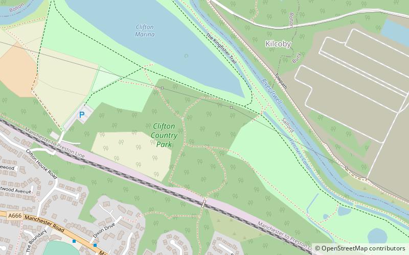
Clifton Country Park, Manchester

Gallery (1)
Map
Map
Facts and practical information
Clifton Country Park is a local nature reserve in the Irwell Valley at Clifton, Greater Manchester, North West England. Situated next to a double bend in the River Irwell, it is north east of the Manchester to Preston railway line and the A666, Manchester Road, Clifton where it is accessible via Clifton House Road opposite Clifton Cricket Club. Junction 16 of the M60 motorway is only about ¼ mile away to the south east. ()
Elevation: 171 ft a.s.l.Coordinates: 53°31'58"N, 2°20'28"W
Address
Salford (Pendlebury)Manchester
ContactAdd
Social media
Add
Getting there by public transportation
Public transportation stops near this location
- Bus
- Train
 Bus
Bus
- Calculate routeChorley Road/Moorside Road 31 min walk
- Calculate routeManchester Road/The Morning Star 33 min walk
- Calculate routeMoorside 32 min walk
- Calculate routeClifton 34 min walk
Maps MetrolinkMaps
 Metrolink / Rail
MetrolinkMapsMetrolink / RailDay trips


Frequently Asked Questions (FAQ)
How to get to Clifton Country Park by public transport?
The nearest stations to Clifton Country Park:
Bus
Train
Bus
- Chorley Road/Moorside Road • Lines: 29 (31 min walk)
- Manchester Road/The Morning Star • Lines: 29 (33 min walk)
Train
- Moorside (32 min walk)
- Clifton (34 min walk)