Trek Zone

Charity Land, Trimdon

#1 among attractions in Trimdon

Sightseeing
Charity Land location map
Map

Facts and practical information
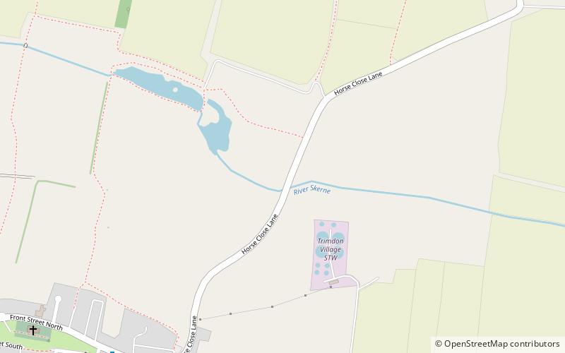
Established: 1999 (25 years ago)Coordinates: 54°42'16"N, 1°25'8"W
Address

Trimdon United Kingdom

Contact
Social media
Add
Day trips

Charity Land – popular in the area (distance from the attraction)

Nearby attractions include: Wynyard Golf Club, Sedgefield Racecourse, Hardwick Hall Country Park, Church of St Edmund.

  • wynyard golf club6.2 miSE
  • sedgefield racecourse stockton on tees4.4 miSW
  • hardwick hall country park sedgefield4 miSW
  • church of st edmund sedgefield3.7 miS
  • gilesgate durham location map
    7.5 miNW
  • wingate quarry1.8 miN
  • the manor house sedgefield3.8 miS
  • durham amateur rowing club location map
    7.3 miNW
  • bishop middleham quarry3 miSW
  • castle eden dene4.8 miNE
  • coxhoe3.5 miW

Where to next? Visit england England region page or discover the top tourist attractions in United Kingdom.