Forest of Bere, Waterlooville
#5 among attractions in Waterlooville
![Forest of Bere location map](https://tzmedia.b-cdn.net/media/images/static-maps/gb/50_9_-1_03333.jpg)
![Forest of Bere, Waterlooville](https://tzmedia.b-cdn.net/media/images/gb/place/gallery/medium/26e52c0df8314abba648da539caa6065.jpg)
Facts and practical information
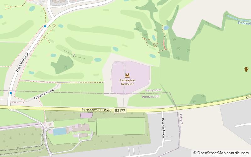
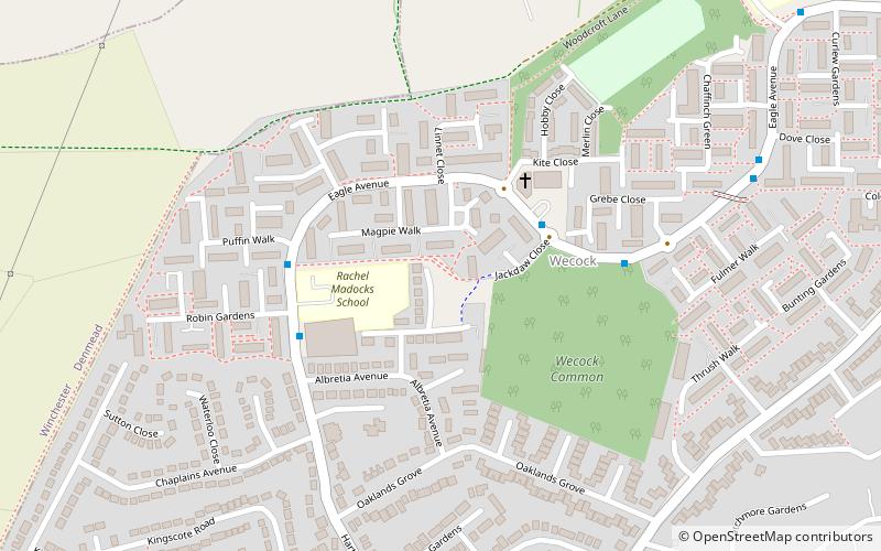
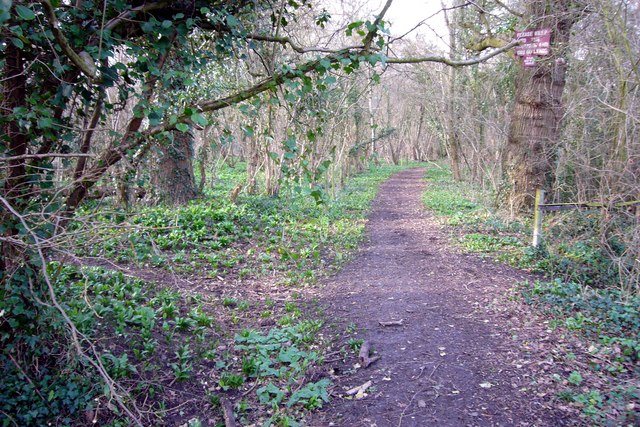
The Forest of Bere is a mixed-use partially forested area in Hampshire immediately north of Fareham, Portsmouth and Roman Road, Havant and including a small part of the South Downs National Park. ()
Waterlooville United Kingdom
Forest of Bere – popular in the area (distance from the attraction)
Nearby attractions include: Butser Ancient Farm, Fort Widley, Waterlooville Baptist Church, Chalton Windmill.
3.9 miNEMuseum, Historical placeButser Ancient Farm, South Downs National Park
99 min walk • Butser Ancient Farm is an archaeological open-air museum located near Petersfield in Hampshire, southern England. Butser features experimental reconstructions of prehistoric, Romano-British and Anglo-Saxon buildings.
3.5 miSWForts and castles, Equestrian trail, ParkFort Widley, Portsmouth
90 min walk • Fort Widley is one of the forts built on top of Portsdown Hill between 1860 and 1868 on the recommendation of the Royal Commission on the Defence of the United Kingdom.
1.1 miSChurchWaterlooville Baptist Church, Waterlooville
29 min walk • Waterlooville Baptist Church is the Baptist place of worship serving the town of Waterlooville and surrounding suburban areas in the borough of Havant in Hampshire, southeast England.
3.5 miNEWindmillChalton Windmill, South Downs National Park
91 min walk • Chalton Windmill is a Grade II listed tower mill on the top of Windmill Hill at Chalton, Hampshire, England, which has been converted to residential use.
3.6 miNEArchaeological siteWindmill Hill, South Downs National Park
91 min walk • Windmill Hill is a chalk hill running alongside the A3 in the East Hampshire district of Hampshire, England, overlooking Chalton to the east, and Clanfield to the west.
3.4 miSWMonastery, Golf, Outdoor activitiesSouthwick Priory
88 min walk • Southwick Priory or Our Lady at Southwick was a priory of Augustinian canons founded in Portchester Castle on Portsmouth Harbour and later transferred 2 miles north to Southwick, Hampshire, England. It ceased at the Dissolution of the Monasteries in 1538.
3.2 miSForts and castlesCamp Down, Waterlooville
83 min walk • Camp Down is a location at Portsdown Hill, Hampshire, near Farlington, which was used as an Admiralty semaphore station and later as a redoubt on the line of Palmerston Forts, Portsmouth.
3.1 miSEShopping centre, Shopping, ParkPark Parade, Havant
81 min walk • Leigh Park is a large suburb of Havant, in Hampshire, England. It currently forms the bulk or whole of four electoral wards: Battins, Bondfields, Barncroft and Warren Park.
1.8 miNParkCatherington Down, South Downs National Park
47 min walk • Catherington Down is a 12.8-hectare biological Site of Special Scientific Interest in Catherington in Hampshire. It is also a Local Nature Reserve This western sloping site is chalk grassland with prominent lynchet strips dating to the Middle Ages.
3.5 miSWMuseum, Military museumSouthwick House
88 min walk • Southwick House is a Grade II listed 19th-century manor house of the Southwick Estate in Hampshire, England, about 5 miles north of Portsmouth. It is home to the Defence School of Policing and Guarding, and related military police capabilities.
3.1 miNNightlifeBat & Ball Inn, Waterlooville
79 min walk • The Bat & Ball Inn near Clanfield, Hampshire, England, is an historic eighteenth-century pub situated opposite the Broadhalfpenny Down cricket ground, the original home of the Hambledon Club. It is traditionally, though erroneously, called "the cradle of cricket".