Glossop Castle, Glossop
Map
Facts and practical information
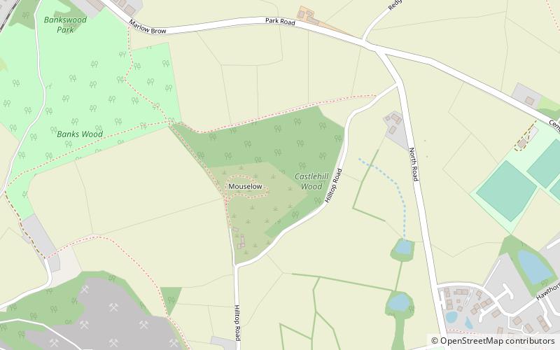
Glossop Castle is a Norman earthwork north of Glossop, off Hilltop Road, 14 miles east of Manchester, on the A57. The site is visible from the main road, standing atop a commanding ridge. Some 12 miles southeast is Peveril Castle. ()
Address
Glossop
ContactAdd
Social media
Add
Getting there by public transportation
Public transportation stops near this location
- Bus
- Train
 Bus
Bus
- Calculate routeHadfield 11 min walk
- Calculate routeDinting 18 min walk
- Calculate routeGlossop 24 min walk
- Calculate routeManor Station 26 min walk
- Calculate routeGlossop, High Street West / opposite Grapes Inn 22 min walk
- Calculate routeDinting Vale, Dinting Vale / opposite Primary School 22 min walk
Day trips


Frequently Asked Questions (FAQ)
Which popular attractions are close to Glossop Castle?
Nearby attractions include St Luke's Church, Glossop (20 min walk), Dinting Viaduct, Glossop (21 min walk), Swineshaw Reservoir, Peak District (23 min walk).
How to get to Glossop Castle by public transport?
The nearest stations to Glossop Castle:
Train
Bus
Train
- Hadfield (11 min walk)
- Dinting (18 min walk)
Bus
- Glossop, High Street West / opposite Grapes Inn • Lines: 394 (22 min walk)
- Dinting Vale, Dinting Vale / opposite Primary School • Lines: 394 (22 min walk)