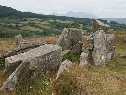
Carn Ban, Isle of Arran
#16 among attractions in Isle of Arran

Facts and practical information
Carn Ban is a Neolithic chambered tomb located on the Isle of Arran in Scotland. ()
Isle of Arran United Kingdom
Isle of Arran plan & book
Unleash the traveler in you — discover the cheapest flight deals, find the perfect hotel or hostel nearby, and search for the best car rental prices. Travel at your own pace to discover new places and enjoy your journey.
Carn Ban – popular in the area (distance from the attraction)
Nearby attractions include: Machrie Moor Stone Circles, Eas a' Chrannaig, Kildonan Castle, Giants' Graves.
 Ruins, Archaeological site
Machrie Moor Stone Circles, Machrie
159 min walk • Machrie Moor Stone Circles is the collective name for six stone circles visible on Machrie Moor near the settlement of Machrie on the Isle of Arran, Scotland.
 Natural attraction, Park, Waterfall
Eas a' Chrannaig, Lamlash
64 min walk • Eas a' Chrannaig also known as the Glenashdale Falls is a waterfall on the island of Arran, Scotland. There are a series of falls on the Glenashdale Burn, which flows from moorland near the summit of Tighvein eastwards towards Whiting Bay, from which there is a tourist trail leading some 4 kilometres up Glenashdale.
 Forts and castles
Kildonan Castle, Isle of Arran
110 min walk • Kildonan Castle stands in the small village of Kildonan on the southern coast of the Isle of Arran in Scotland. The castle's name is derived from the name of a former resident, Saint Donan, who is said to be buried on the island.
 Archaeological site
Giants' Graves, Isle of Arran
86 min walk • The Giants' Graves are the remains of two Neolithic chambered tombs on the Isle of Arran in Scotland. They are situated within 40 metres of each other, and stand on a ridge 120 metres above the sea in a clearing in a forest, overlooking Whiting Bay to the south.
 Archaeological site
Torrylin Cairn, Isle of Arran
99 min walk • Torrylin Cairn is the remains of a Neolithic chambered tomb. It is located near Kilmory on the Isle of Arran in Scotland.
 Nature, Natural attraction, Mountain
Tighvein, Isle of Arran
24 min walk • Tighvein is a hill above Lamlash on the Isle of Arran in western Scotland. It is a Marilyn and the highest point on the south-eastern section of the island, south-east of the pass of Monambre Glen.
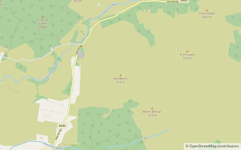 Nature, Natural attraction, Mountain
Àrd Bheinn, Isle of Arran
128 min walk • Àrd Bheinn is a small mountain of 1678 feet on central Isle of Arran in western Scotland.
 Lighthouse, Vernacular architecture
Pladda Lighthouse, Pladda
128 min walk • Pladda Lighthouse is an active 18th century lighthouse situated at the southern end of the island of Pladda. The lighthouse dates from 1790 and was designed by Thomas Smith.
 Archaeological site
Torr a'Chaisteal, Isle of Arran
119 min walk • Torr a'Chaisteal is an Iron Age fort, located about 1 mile northeast of the village of Sliddery, on the Isle of Arran in Scotland.
 Church
Bennecarrigan Free Church, Isle of Arran
101 min walk • The Bennecarrigan Free Church is a place of worship of the Free Church of Scotland in Kilmory, on the island of Arran, Scotland. The church was built in 1893.
 Archaeological site
Kilpatrick Dun, Isle of Arran
134 min walk • Kilpatrick Dun is an Iron Age dun, located about 1 mile south of the village of Blackwaterfoot on the Isle of Arran in Scotland.


