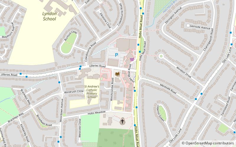
Hobs Moat Library, Solihull

Gallery (1)
Map
Map
Facts and practical information
Hobs Moat Library (address: Ulleries Road) is a place located in Solihull (England kingdom) and belongs to the category of library.
It is situated at an altitude of 348 feet, and its geographical coordinates are 52°26'39"N latitude and 1°47'9"W longitude.
Planning a visit to this place, one can easily and conveniently get there by public transportation. Hobs Moat Library is a short distance from the following public transport stations: Windsor Drive (bus, 7 min walk), Olton (train, 23 min walk).
Among other places and attractions worth visiting in the area are: Elmdon Park (park, 22 min walk), Olton (area, 25 min walk), St Nicholas' Church, Birmingham (church, 25 min walk).
Coordinates: 52°26'39"N, 1°47'9"W
Getting there by public transportation
Public transportation stops near this location
- Bus
- Train
 Bus
Bus
- Calculate routeWindsor Drive 7 min walk
- Calculate routeLode Lane / Old Lode Lane 9 min walk
- Calculate routeOld Lode Lane / Hatchford Brook 10 min walk
- Calculate routeOlton 23 min walk
Day trips


Frequently Asked Questions (FAQ)
How to get to Hobs Moat Library by public transport?
The nearest stations to Hobs Moat Library:
Bus
Train
Bus
- Windsor Drive • Lines: X2 (7 min walk)
- Lode Lane / Old Lode Lane • Lines: X2 (9 min walk)
Train
- Olton (23 min walk)