Landseer Park, Ipswich

Gallery (1)
Map
Map
Facts and practical information
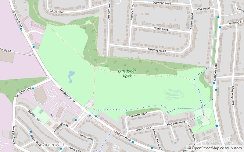
Landseer Park is a large open green space north of Landseer Road, in the eastern suburbs of Ipswich, Suffolk, England. It is home to the Ipswich BMX Club. National Cycle Route 51 passes through the park. It is designated a County Wildlife Site. ()
Elevation: 102 ft a.s.l.Coordinates: 52°2'23"N, 1°10'25"E
Address
South East Ipswich (Gainsborough)Ipswich
ContactAdd
Social media
Add
Getting there by public transportation
Public transportation stops near this location
- Bus
- Train
 Bus
Bus
- Calculate routeHolbrook Road 4 min walk
- Calculate routeBus Shelter 5 min walk
- Calculate routeHogarth Road 6 min walk
- Calculate routeBonnington Road 7 min walk
- Calculate routeDerby Road 22 min walk
Day trips


Frequently Asked Questions (FAQ)
Which popular attractions are close to Landseer Park?
Nearby attractions include Holywells Park, Ipswich (14 min walk), Cliff Brewery, Ipswich (14 min walk), Pipers Vale, Ipswich (17 min walk), Leighton Road Evangelical Church, Ipswich (18 min walk).
How to get to Landseer Park by public transport?
The nearest stations to Landseer Park:
Bus
Train
Bus
- Holbrook Road • Lines: 1, 3E (4 min walk)
- Bus Shelter • Lines: 1, 3E (5 min walk)
Train
- Derby Road (22 min walk)