Raggedstone Hill
#4459 among destinations in the United Kingdom


Facts and practical information
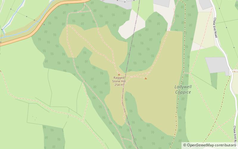
Raggedstone Hill is situated on the range of Malvern Hills that runs approximately 13 kilometres north-south along the Herefordshire-Worcestershire border. Raggedstone Hill lies close to the borders of Herefordshire, Worcestershire and Gloucestershire. It has an elevation of 254 metres. ()
EnglandUnited Kingdom
Raggedstone Hill – popular in the area (distance from the attraction)
Nearby attractions include: British Camp, Malvern Hills, Eastnor Castle, Herefordshire Beacon.
 Forts and castles, Hill
British Camp
57 min walk • British Camp is an Iron Age hill fort located at the top of Herefordshire Beacon in the Malvern Hills. The hill fort is protected as a Scheduled Ancient Monument and is owned and maintained by Malvern Hills Conservators. The fort is thought to have been first constructed in the 2nd century BC. A Norman castle was built on the site.
 Walking trails with sweeping views
Malvern Hills, Malvern
104 min walk • The Malvern Hills are in the English counties of Worcestershire, Herefordshire and a small area of northern Gloucestershire, dominating the surrounding countryside and the towns and villages of the district of Malvern.
 Historical place, Park, Forts and castles
Eastnor Castle, Ledbury
39 min walk • Eastnor Castle, Eastnor, Herefordshire, is a 19th-century mock castle. Eastnor was built for The 1st Earl Somers, who employed Robert Smirke, who was later to work at the British Museum, as his architect. The castle was built between 1811–1820.
 Nature, Natural attraction, Hill
Herefordshire Beacon
57 min walk • The Herefordshire Beacon is one of the highest peaks of the Malvern Hills, and is high enough to be classified as a mountain. It is surrounded by a British Iron Age hill fort earthwork known as British Camp.
 Canal
CanalHerefordshire and Gloucestershire Canal
92 min walk • The Herefordshire and Gloucestershire Canal is a canal in the west of England, which ran from Hereford to Gloucester, where it linked to the River Severn.
 Archaeological site
Pinnacle Hill
91 min walk • Pinnacle Hill is situated in the range of Malvern Hills in England, running about 13 kilometres north-south along the Herefordshire-Worcestershire border. It lies between Jubilee Hill and Black Hill and has an elevation of 357 metres. It is the site of two possible Bronze Age round barrows.
 Monastery
Little Malvern Priory, Malvern
65 min walk • Little Malvern Priory, in the village of Little Malvern near Malvern, Worcestershire, was a Benedictine monastery c. 1171–1537. It was founded from Worcester Cathedral. Little remains of the 12th-century church, which was rebuilt in 1480–1482. The site is now occupied by house named Little Malvern Court, which has limited public opening.
 Forts and castles
Bronsil Castle, Ledbury
20 min walk • Bronsil Castle was a fortified manor house about 1 mile to the east of Eastnor in Herefordshire, England near Ledbury. It is a Grade II* listed building, first listed in 1967.
 Church
Gadfield Elm Chapel
91 min walk • The Gadfield Elm Chapel near the village of Pendock in Worcestershire, England, is the oldest extant chapel of The Church of Jesus Christ of Latter-day Saints.
 Nature, Natural attraction, Hill
Jubilee Hill
98 min walk • Jubilee Hill is situated in the range of Malvern Hills that runs about 13 kilometres north-south along the Herefordshire-Worcestershire border. It lies between Perseverance Hill and Pinnacle Hill and has an elevation of 327 metres. Jubilee Hill was named by the Malvern Hills Conservators in 2002 in honour of The Queen's Golden Jubilee.
 Nature, Natural attraction, Hill
Midsummer Hill
18 min walk • Midsummer Hill is situated in the range of Malvern Hills that runs approximately 13 kilometres north-south along the Herefordshire-Worcestershire border. It lies to the south of Herefordshire Beacon with views to Eastnor Castle. It has an elevation of 284 metres. To the north is Swinyard Hill.
