The Gullet, Maidenhead

Gallery (1)
Map
Map
Facts and practical information
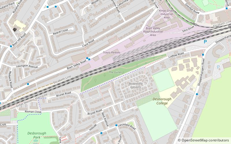
The Gullet is a 2.1-hectare Local Nature Reserve in Maidenhead in Berkshire. It is owned and managed by the Royal Borough of Windsor and Maidenhead. ()
Elevation: 135 ft a.s.l.Coordinates: 51°30'58"N, 0°43'56"W
Address
Maidenhead
ContactAdd
Social media
Add
Getting there by public transportation
Public transportation stops near this location
- Bus
- Train
 Bus
Bus
- Calculate routeMaidenhead 12 min walk
- Calculate routeFurze Platt 31 min walk
- Calculate routeGrenfell Place 12 min walk
- Calculate routeFrascati Way 13 min walk
- Calculate routeRailway Bridge 13 min walk
- Calculate routeBroadway 16 min walk
Day trips


Frequently Asked Questions (FAQ)
Which popular attractions are close to The Gullet?
Nearby attractions include All Saints' Church, Maidenhead (9 min walk), Norden Farm Centre for the Arts, Maidenhead (16 min walk), Maidenhead Heritage Centre, Maidenhead (18 min walk), Maidenhead Town Hall, Maidenhead (18 min walk).
How to get to The Gullet by public transport?
The nearest stations to The Gullet:
Train
Bus
Train
- Maidenhead (12 min walk)
- Furze Platt (31 min walk)
Bus
- Grenfell Place • Lines: 4 (12 min walk)
- Frascati Way • Lines: 15, 4, 63, 68 (13 min walk)