Maidenhead Town Hall, Maidenhead

Gallery (1)
Map
Map
Facts and practical information
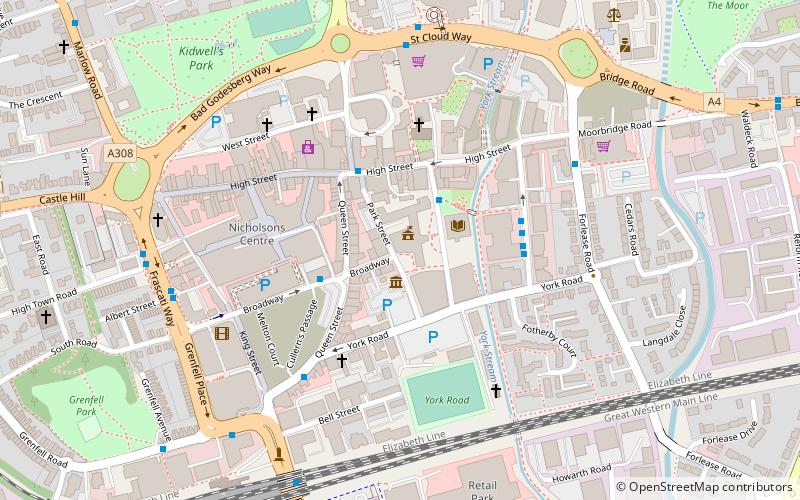
Maidenhead Town Hall is a municipal building in St Ives Road, Maidenhead, Berkshire, England. ()
Coordinates: 51°31'18"N, 0°43'8"W
Getting there by public transportation
Public transportation stops near this location
- Bus
- Train
 Bus
Bus
- Calculate routeLibrary 2 min walk
- Calculate routeBroadway 2 min walk
- Calculate routeMarket Street 3 min walk
- Calculate routeBridge Avenue 3 min walk
- Calculate routeMaidenhead 8 min walk
- Calculate routeFurze Platt 23 min walk
Day trips


Frequently Asked Questions (FAQ)
Which popular attractions are close to Maidenhead Town Hall?
Nearby attractions include Maidenhead Heritage Centre, Maidenhead (1 min walk), St Mary's Church, Maidenhead (3 min walk), St Luke's Church, Maidenhead (10 min walk), Maidenhead Waterways, Maidenhead (10 min walk).
How to get to Maidenhead Town Hall by public transport?
The nearest stations to Maidenhead Town Hall:
Bus
Train
Bus
- Library • Lines: 15 (2 min walk)
- Broadway • Lines: 15, 63 (2 min walk)
Train
- Maidenhead (8 min walk)
- Furze Platt (23 min walk)