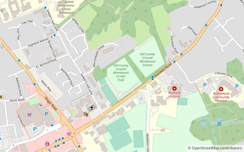
Old County Ground, Brentwood
Map
Facts and practical information
Old County Ground is a cricket ground in Brentwood, Essex. The first recorded match on the ground was in 1876, when Essex played Suffolk in a non first-class match. ()
Coordinates: 51°37'26"N, 0°18'33"E
Address
Brentwood
ContactAdd
Social media
Add
Getting there by public transportation
Public transportation stops near this location
- Bus
- Train
 Bus
Bus
- Calculate routeMiddleton Hall Lane 3 min walk
- Calculate routeCrescent Drive 5 min walk
- Calculate routeHighland Avenue 7 min walk
- Calculate routeBrentwood 21 min walk
- Calculate routeShenfield 26 min walk
Day trips


Frequently Asked Questions (FAQ)
Which popular attractions are close to Old County Ground?
Nearby attractions include Brentwood Cathedral, Brentwood (10 min walk), Brentwood Town Hall, Brentwood (10 min walk), Cranbrook Strict Baptist Chapel, Brentwood (20 min walk).
How to get to Old County Ground by public transport?
The nearest stations to Old County Ground:
Bus
Train
Bus
- Middleton Hall Lane • Lines: 251, 350, 351, 80A, 80C, 81 (3 min walk)
- Crescent Drive • Lines: 251, 350, 351, 80A, 80C, 81 (5 min walk)
Train
- Brentwood (21 min walk)
- Shenfield (26 min walk)