City Cemetery, Derry
Facts and practical information
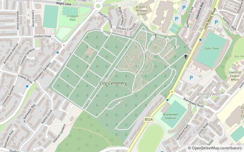
Derry City Cemetery, known locally as the City Cemetery, is a cemetery based in the Creggan area of Derry, Northern Ireland. By the mid-19th century Derry’s graveyards were becoming overcrowded, and soon would reach capacity. To alleviate the strain the cemetery was opened in 1853, becoming the first municipal cemetery in the city. By 1867 the graveyards at St Columb's Cathedral, St. Augustine’s Church, and Long Tower Chapel had all stopped accepting ‘new’ burials. Due to this the cemetery became the main burial ground for the city's Protestant and Catholic population. It is the final resting place for over 70,000 people and includes graves to victims of the cholera pandemics of the late 1800s, as well as graves of those who fought in WWII. Hunger striker and INLA member Patsy O'Hara is also buried in the cemetery. ()
Derry
- Bus
- Train
 Bus
Bus
- Calculate routeFoyle Bus Station 24 min walk
- Calculate routeLondonderry 28 min walk


Frequently Asked Questions (FAQ)
Which popular attractions are close to City Cemetery?
How to get to City Cemetery by public transport?
Bus
- Foyle Bus Station (24 min walk)
Train
- Londonderry (28 min walk)