Wilder's Folly
#2424 among destinations in the United Kingdom

Facts and practical information
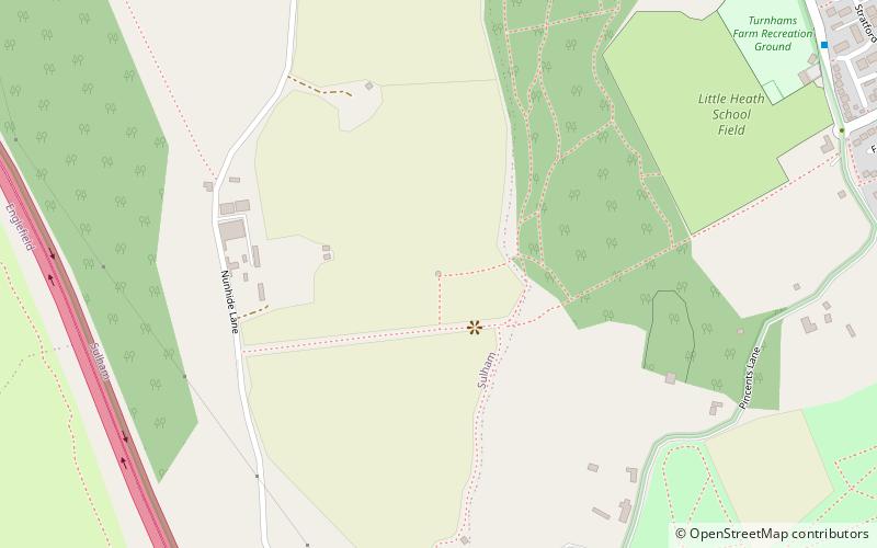
Wilder's Folly is a folly and dovecote at Nunhide, near the village of Sulham in the English county of Berkshire. ()
Wilder's Folly plan & book
Unleash the traveler in you — discover the cheapest flight deals, find the perfect hotel or hostel nearby, and search for the best car rental prices. Travel at your own pace to discover new places and enjoy your journey.
Wilder's Folly – popular in the area (distance from the attraction)
Nearby attractions include: Calcot Park, Sheffield Lock, Burghfield Lock, Blundells Copse.
 Golf
GolfCalcot Park, Reading
35 min walk • Calcot Park is a country house, estate, and golf club in the English county of Berkshire. It is situated between Calcot and Tilehurst, suburbs of the town of Reading, and within the civil parish of Tilehurst. It is north of the Bath Road.
 Canal
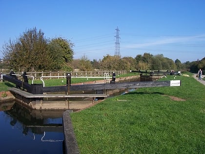
CanalSheffield Lock
34 min walk • Sheffield Lock, at grid reference SU648706, is a lock on the Kennet and Avon Canal, in the civil parish of Burghfield in the English county of Berkshire. It is also sometimes known as Shenfield Lock.
 Canal
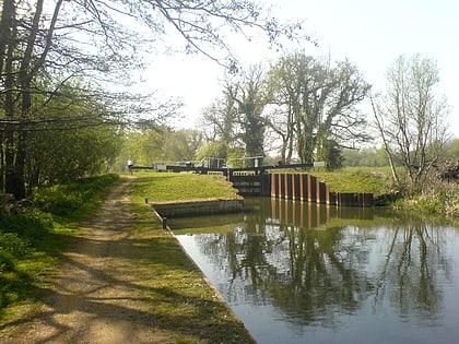
CanalBurghfield Lock, Reading
47 min walk • Burghfield Lock is a lock on the River Kennet at Burghfield in the English county of Berkshire. Burghfield Lock was built between 1718 and 1723 under the supervision of the engineer John Hore of Newbury, and this stretch of the river is now administered by the Canal & River Trust and known as the Kennet Navigation.
 Park
ParkBlundells Copse, Reading
42 min walk • Blundells Copse is a local nature reserve in the suburb of Tilehurst in the town of Reading, UK. The site is 5.55 hectares in size, and comprises a close growing, ancient woodland with a stream.
 Park
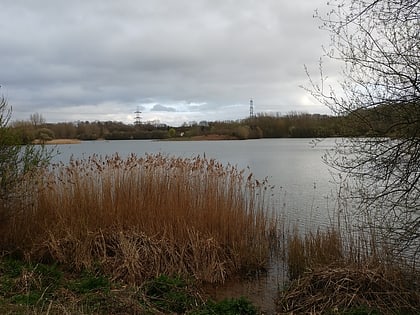
ParkHosehill Lake
44 min walk • Hosehill Lake is a 23.6-hectare Local Nature Reserve west of Reading in Berkshire. It is owned by West Berkshire Council and managed by the Berkshire, Buckinghamshire and Oxfordshire Wildlife Trust.
 Church
Church of St Michael, Reading
40 min walk • St. Michael's Church, Tilehurst, is the parish church of Tilehurst in the English county of Berkshire. It is a parish of the Church of England in the Diocese of Oxford. The church dates from the 12th century, although the oldest part of the current building is the south aisle, built round about 1300, now dedicated as the Lady Chapel.
 Park
ParkMcIlroy Park, Reading
53 min walk • McIlroy Park is a 12-hectare Local Nature Reserve in Tilehurst, a suburb of Reading in Berkshire. It is owned and managed by Reading Borough Council. Along with Blundells Copse and Lousehill Copse it is part of West Reading Woodlands.
 Tower
TowerTilehurst Water Tower, Reading
23 min walk • Tilehurst Water Tower, is a distinctive water tower in Tilehurst, a suburb of the English town of Reading. People from Reading know they are near home when they are coming eastbound along the M4 and they can see the top of the tower.
 Canal
CanalSulhamstead Lock
48 min walk • Sulhamstead Lock is a lock on the River Kennet at Sulhamstead in the English county of Berkshire. Sulhamstead Lock was built between 1718 and 1723 under the supervision of the engineer John Hore of Newbury, and this stretch of the river is now administered by the Canal & River Trust and known as the Kennet Navigation.
 Canal
CanalGarston Lock
31 min walk • Garston Lock is a lock on the Kennet and Avon Canal. It is near the M4 motorway and near Reading, England. Garston Lock was built between 1718 and 1723 under the supervision of the engineer John Hore of Newbury, and this stretch of the river is now administered by Canal & River Trust and known as the Kennet Navigation.
 Park
ParkEnglefield House
44 min walk • Englefield House is an Elizabethan country house with surrounding estate at Englefield in the English county of Berkshire. The gardens are open to the public all year round on particular weekdays and the house by appointment only for large groups.


