British hardened field defences of World War II, Forest of Bowland
#2 among attractions in Forest of Bowland
Facts and practical information
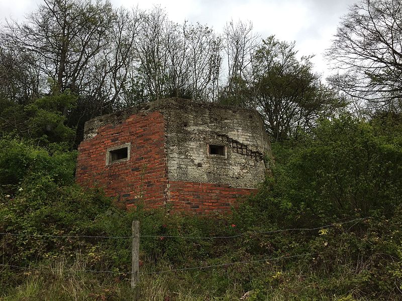
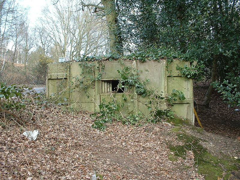
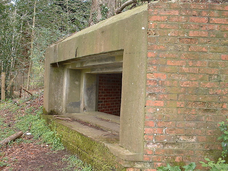
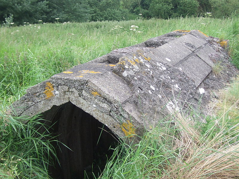
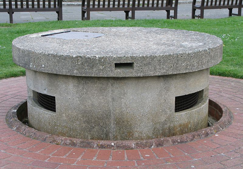
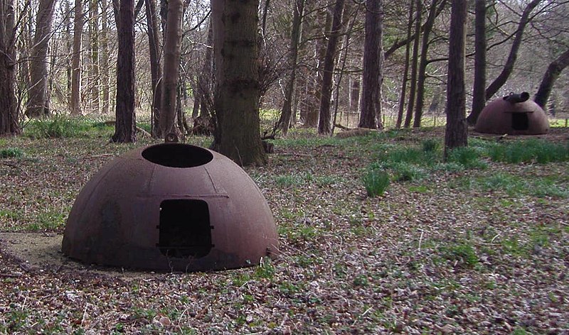
British hardened field defences of World War II were small fortified structures constructed as a part of British anti-invasion preparations. They were popularly known as pillboxes, a reference to their shape. ()
Forest of Bowland United Kingdom
Forest of Bowland plan & book
Unleash the traveler in you — discover the cheapest flight deals, find the perfect hotel or hostel nearby, and search for the best car rental prices. Travel at your own pace to discover new places and enjoy your journey.
British hardened field defences of World War II – popular in the area (distance from the attraction)
Nearby attractions include: Lancashire Witches Walk, St Andrew, Easington Fell, Scheduled monuments in Lancashire.
- 5.2 miSEHiking, Hiking trail
Lancashire Witches Walk
132 min walk • The Lancashire Witches Walk is a hauntingly picturesque hiking trail that weaves through the scenic countryside of Lancashire, United Kingdom. This trail is steeped in history, spanning approximately 51 miles, and is designed to commemorate the tragic story of the...
- 5 miSEChurch
St Andrew
129 min walk • St Andrew's Church is in Church Street, Slaidburn, Lancashire, England. It is an active Anglican parish church in the deanery of Bowland, the archdeaconry of Craven, and the Diocese of Leeds. Its benefice is united with that of St George, Dunsop Bridge.
- 7.3 miSEHill
Easington Fell, Forest of Bowland
187 min walk • Easington Fell is a Marilyn in the Forest of Bowland in Lancashire, England. It has been surveyed to be 70 cm higher than a nearby fell of almost identical height, namely, Waddington Fell. This is visible in the background of the photo.
- 6.1 miSEMemorial
Scheduled monuments in Lancashire, Forest of Bowland
156 min walk • This is a list of scheduled monuments in the English county of Lancashire. In the United Kingdom, a scheduled monument is a "nationally important" archaeological site or historic building that has been given protection against unauthorised change by being placed on a list by the...
- 5.4 miWNature, Natural attraction, Hill
Grit Fell
139 min walk • Grit Fell is a lonely hill between Clougha Pike and Ward's Stone in the Forest of Bowland in Lancashire, England. Covered by heather and large bogs, it is difficult walking country.
- 3.4 miWHill
Ward's Stone, Forest of Bowland
86 min walk • Ward's Stone is the highest hill in the Forest of Bowland, England. Its flat top hides two trig points nearly a kilometre apart.
- 1.2 miNWHill
Wolfhole Crag, Forest of Bowland
30 min walk • Wolfhole Crag is a lonely and seldom-visited hill in the Forest of Bowland in Lancashire, England. Its seclusion is due in part to its low profile and long approach walks. A long path approaches from Ward's Stone in the west which is fraught with bogs. Another tarmac path from Tarnbrook meets this half way.
- 5.5 miNChurch
Church of the Good Shepherd
141 min walk • The Church of the Good Shepherd is on Tatham Fell in Lancashire, England. It is an active Anglican parish church in the deanery of Tunstall, the archdeaconry of Lancaster and the diocese of Blackburn.
- 2.4 miNENature, Natural attraction, Hill
White Hill
61 min walk • White Hill is a hill in the Forest of Bowland, north-western England. It lies between Slaidburn and High Bentham. The summit houses a tower and a trig point. In medieval times, the hill marked one of the northernmost limits of the Lordship of Bowland.
- 2.6 miSMountain pass, Valley, Park
Trough of Bowland, Lancaster
66 min walk • The Trough of Bowland is a valley and high pass in the Forest of Bowland Area of Outstanding Natural Beauty, Lancashire, England.
- 5 miSWNature, Natural attraction, Hill
Hawthornthwaite Fell, Forest of Bowland
128 min walk • Hawthornthwaite Fell is one of the larger hills in the Forest of Bowland in Lancashire, England, occupying a north-facing position on the south-western range, close to Bleasdale and Fair Snape Fell.