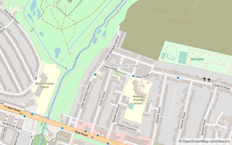
Orchard Village, Dagenham
Map
Facts and practical information
Orchard Village, formerly known as the Mardyke Estate, is a housing development in the South Hornchurch area of London, England. ()
Coordinates: 51°31'44"N, 0°10'10"E
Address
Havering (South Hornchurch)Dagenham
ContactAdd
Social media
Add
Getting there by public transportation
Public transportation stops near this location
- Metro
- Bus
- Train
 Metro
Metro
- Calculate routeOrchard Village / Lowen Road 2 min walk
- Calculate routeSpencer Road 6 min walk
- Calculate routeSouth Street 6 min walk
- Calculate routeDagenham Dock 26 min walk
- Calculate routeRainham 32 min walk
- Calculate routeDagenham East 28 min walk
Day trips


Frequently Asked Questions (FAQ)
Which popular attractions are close to Orchard Village?
Nearby attractions include Beam Park, Dagenham (7 min walk), Beam Reach, Dagenham (16 min walk), Hornchurch Marshes, Dagenham (20 min walk), Dagenham Village Churchyard, London (20 min walk).
How to get to Orchard Village by public transport?
The nearest stations to Orchard Village:
Bus
Train
Metro
Bus
- Orchard Village / Lowen Road • Lines: 365 (2 min walk)
- Spencer Road • Lines: 365 (6 min walk)
Train
- Dagenham Dock (26 min walk)
- Rainham (32 min walk)
Metro
- Dagenham East • Lines: District (28 min walk)