Beam Park, Dagenham
Facts and practical information
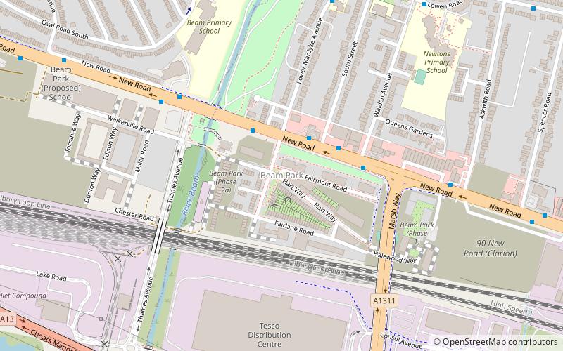
Beam Park is a new neighbourhood in the south of the London Borough of Barking and Dagenham and the London Borough of Havering. It is named after the River Beam which forms the boundary between the boroughs. It will be served by Beam Park railway station in Havering. 2899 homes are planned, with 2166 in Barking and Dagenham and 733 in Havering. It will include a town centre in the Havering part of the development. It covers an area of 29 hectares. It previously formed part of the Ford Dagenham plant site. The development is a joint venture between London and Quadrant and Countryside Properties. Planning consent was given in September 2018 and construction began in May 2019. It is part of the London Riverside opportunity area and is designated as a housing zone by the Greater London Authority. ()
Havering (South Hornchurch)Dagenham
- Metro
- Bus
- Train
 Metro
Metro
- Calculate routeSouth Street 3 min walk
- Calculate routeLower Mardyke Avenue 2 min walk
- Calculate routeDagenham Dock 22 min walk
- Calculate routeRainham 31 min walk
- Calculate routeDagenham Heathway 37 min walk


Frequently Asked Questions (FAQ)
Which popular attractions are close to Beam Park?
How to get to Beam Park by public transport?
Bus
- South Street • Lines: 174, 287, 365 (3 min walk)
- Lower Mardyke Avenue • Lines: 174, 287 (2 min walk)
Train
- Dagenham Dock (22 min walk)
- Rainham (31 min walk)
Metro
- Dagenham Heathway • Lines: District (37 min walk)