Wilford Hill, Nottingham

Gallery (1)
Map
Map
Facts and practical information
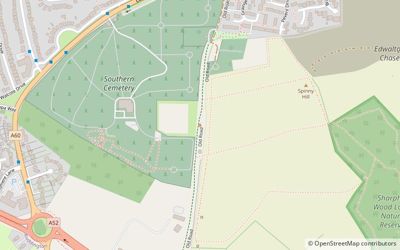
Wilford Hill is the highest point in Nottinghamshire on the Trent's south bank, giving views of the Trent Valley as far as Newark-on-Trent. ()
Coordinates: 52°54'36"N, 1°8'15"W
Address
Nottingham
ContactAdd
Social media
Add
Getting there by public transportation
Public transportation stops near this location
- Bus
- Tram
 Bus
Bus
- Calculate routeCemetery 7 min walk
- Calculate routeStanhome Drive 7 min walk
- Calculate routeGreythorn Drive 8 min walk
- Calculate routeRuddington Lane 24 min walk
- Calculate routeCompton Acres 27 min walk
- Calculate routeWilford Lane 35 min walk
Day trips


Frequently Asked Questions (FAQ)
How to get to Wilford Hill by public transport?
The nearest stations to Wilford Hill:
Bus
Tram
Bus
- Cemetery • Lines: 8, 9, (N) N6 (7 min walk)
- Stanhome Drive • Lines: 8, 9, (N) N6 (7 min walk)
Tram
- Ruddington Lane • Lines: 2 (24 min walk)
- Compton Acres • Lines: 2 (27 min walk)