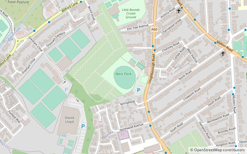
West Park, Nottingham
Map
Facts and practical information
West Park is a cricket ground in West Bridgford, Nottinghamshire. The ground was constructed by cricket philanthropist Sir Julien Cahn. The first recorded match on the ground was in 1928, when Sir J Cahn's XI played the touring West Indies in a non first-class match. In 1932 the ground held its first first-class match when Sir J Cahn's XI played the touring South Americans. The ground held 2 further first-class matches, both of which came in 1935 when Sir J Cahn's XI played Leicestershire and Lancashire. Sir J Cahn's XI last played at the ground in 1941 when they took on a British Empire XI. ()
Coordinates: 52°55'39"N, 1°8'23"W
Address
Nottingham
ContactAdd
Social media
Add
Getting there by public transportation
Public transportation stops near this location
- Bus
- Tram
 Bus
Bus
- Calculate routeChestnut Grove 4 min walk
- Calculate routeChantrey Road 4 min walk
- Calculate routeChaworth Road 5 min walk
- Calculate routeWilford Lane 18 min walk
- Calculate routeCompton Acres 24 min walk
- Calculate routeMeadows Embankment 26 min walk
Day trips


Frequently Asked Questions (FAQ)
Which popular attractions are close to West Park?
Nearby attractions include Wilford Suspension Bridge, Nottingham (11 min walk), West Bridgford, Nottingham (11 min walk), City War Memorial, Nottingham (13 min walk), Friary United Reformed Church, Nottingham (14 min walk).
How to get to West Park by public transport?
The nearest stations to West Park:
Bus
Tram
Bus
- Chestnut Grove • Lines: 10, 9 (4 min walk)
- Chantrey Road • Lines: 10 (4 min walk)
Tram
- Wilford Lane • Lines: 2 (18 min walk)
- Compton Acres • Lines: 2 (24 min walk)