Hare Hall, Romford
Map
Facts and practical information
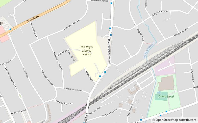
Hare Hall is a house and grounds located in Gidea Park in the London Borough of Havering, east London. ()
Coordinates: 51°35'8"N, 0°12'36"E
Address
Havering (Ardleigh Green)Romford
ContactAdd
Social media
Add
Getting there by public transportation
Public transportation stops near this location
- Bus
- Train
 Bus
Bus
- Calculate routeRoyal Liberty School 2 min walk
- Calculate routeBelgrave Avenue 4 min walk
- Calculate routeDurham Avenue 7 min walk
- Calculate routeWestern Avenue 7 min walk
- Calculate routeGidea Park 9 min walk
- Calculate routeHarold Wood 30 min walk
- Calculate routeEmerson Park 32 min walk
Day trips


Frequently Asked Questions (FAQ)
Which popular attractions are close to Hare Hall?
Nearby attractions include Ardleigh Green, Brentwood (9 min walk), Gallows Corner, Romford (14 min walk), Gidea Park, Romford (15 min walk), Lodge Farm Park, Romford (22 min walk).
How to get to Hare Hall by public transport?
The nearest stations to Hare Hall:
Bus
Train
Bus
- Royal Liberty School • Lines: 496, 674 (2 min walk)
- Belgrave Avenue • Lines: 496, 674 (4 min walk)
Train
- Gidea Park (9 min walk)
- Harold Wood (30 min walk)