Rise Park, Romford
Map
Facts and practical information
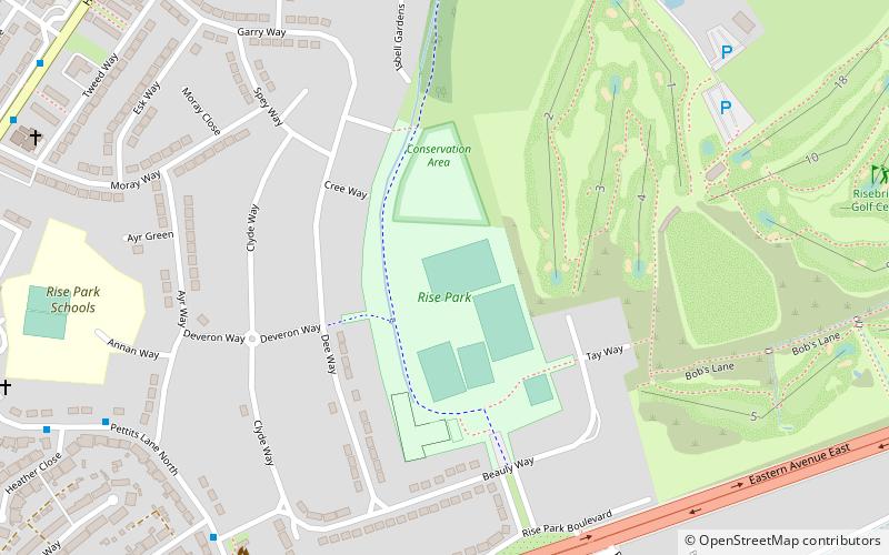
Rise Park is an area of Romford, a district in the London Borough of Havering. It is one of a series of parks which stretch northwards from the railway line at Romford. The southern entrance to Rise Park is just north of the A12 Eastern Avenue, and the northern entrance is on Lower Bedfords Road. It does have a further four other entrances located in Beauly Way, Dee Way, Garry Close, and Isbell Gardens. Rise Park has a significant number of bungalows located in the area. There has been a number of new housing developments in the area. ()
Elevation: 98 ft a.s.l.Coordinates: 51°35'49"N, 0°11'6"E
Address
Havering (Pettits)Romford
ContactAdd
Social media
Add
Getting there by public transportation
Public transportation stops near this location
- Bus
- Train
 Bus
Bus
- Calculate routeHeather Gardens 8 min walk
- Calculate routeMoray Way 10 min walk
- Calculate routeGarry Way 10 min walk
- Calculate routeGidea Park 36 min walk
Day trips


Frequently Asked Questions (FAQ)
Which popular attractions are close to Rise Park?
Nearby attractions include Raphael Park, London (16 min walk), Chase Cross, Romford (19 min walk), Bedfords Park, London (20 min walk), Gidea Park, Romford (21 min walk).
How to get to Rise Park by public transport?
The nearest stations to Rise Park:
Bus
Train
Bus
- Heather Gardens • Lines: 103, 499 (8 min walk)
- Moray Way • Lines: 103, 499 (10 min walk)
Train
- Gidea Park (36 min walk)