St James' Parish Church, Glasgow
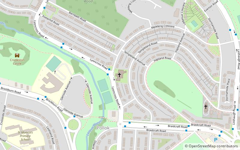
Map
Facts and practical information
St James' Parish Church is a 19th-century parish church of the Church of Scotland in the Pollok area of Glasgow. ()
Coordinates: 55°50'4"N, 4°20'55"W
Address
PollokGlasgow
ContactAdd
Social media
Add
Getting there by public transportation
Public transportation stops near this location
- Bus
- Train
 Bus
Bus
- Calculate routeMosspark 12 min walk
- Calculate routeCorkerhill 15 min walk
- Calculate routeCrookston 22 min walk
- Calculate routeCrookston Road / Brockburn Road 14 min walk
Day trips


Frequently Asked Questions (FAQ)
Which popular attractions are close to St James' Parish Church?
Nearby attractions include Crookston Castle, Glasgow (8 min walk), Corkerhill, Glasgow (16 min walk), Cardonald Place Farm, Glasgow (18 min walk), Cardonald Parish Church, Glasgow (22 min walk).
How to get to St James' Parish Church by public transport?
The nearest stations to St James' Parish Church:
Train
Bus
Train
- Mosspark (12 min walk)
- Corkerhill (15 min walk)
Bus
- Crookston Road / Brockburn Road • Lines: 3 (14 min walk)