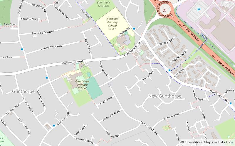
Gunthorpe, Peterborough
Map
Facts and practical information
Gunthorpe is a residential area of the city of Peterborough in the United Kingdom. Since 2015 Gunthorpe has its own ward within Peterborough City Council that also encompasses parts of South Werrington. ()
Coordinates: 52°36'40"N, 0°15'3"W
Address
Peterborough
ContactAdd
Social media
Add
Getting there by public transportation
Public transportation stops near this location
- Bus
 Bus
Bus
- Calculate routeNorwood School 4 min walk
- Calculate routeMealsgate 5 min walk
- Calculate routeMendip Grove 6 min walk
- Calculate routeDerwent Drive 7 min walk
Day trips


Frequently Asked Questions (FAQ)
How to get to Gunthorpe by public transport?
The nearest stations to Gunthorpe:
Bus
Bus
- Norwood School • Lines: citi 2 (4 min walk)
- Mealsgate • Lines: citi 2 (5 min walk)