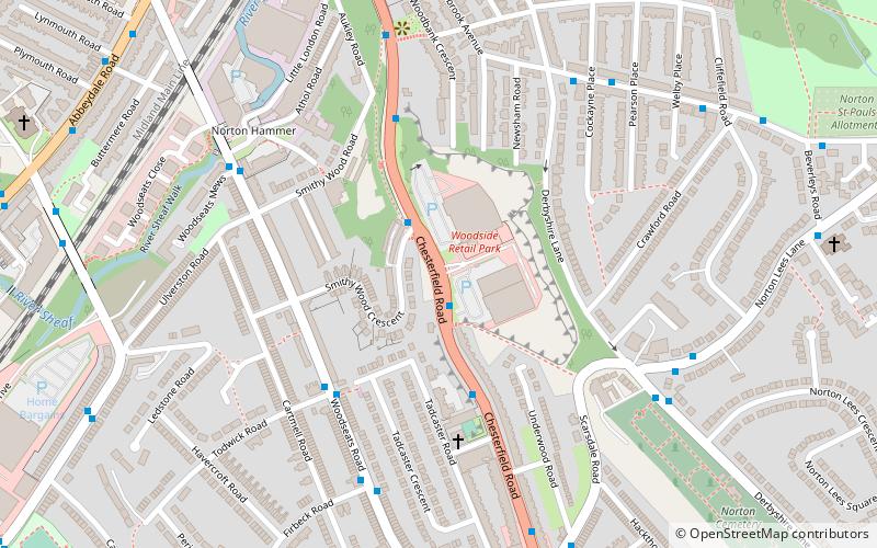
Chesterfield Road, Sheffield
Map
Facts and practical information
Chesterfield Road is a shopping street in Sheffield, England. It leads south from the suburb of Meersbrook to Woodseats, before becoming Meadowhead at the Abbey Lane junction, next to the Abbey pub. The road starts at Toll Bar bridge on the Meers Brook, the former boundary between Yorkshire and Derbyshire. There the road changes name from London Road to Chesterfield Road. ()
Coordinates: 53°20'59"N, 1°28'51"W
Address
Gleadless ValleySheffield
ContactAdd
Social media
Add
Getting there by public transportation
Public transportation stops near this location
- Bus
 Bus
Bus
- Calculate routeWoodseats Road/Todwick Road 4 min walk
- Calculate routeNorton Lees Road/Derbyshire Lane 5 min walk
Day trips


Frequently Asked Questions (FAQ)
Which popular attractions are close to Chesterfield Road?
Nearby attractions include Norton Cemetery, Sheffield (8 min walk), St Paul's Church and Centre, Sheffield (9 min walk), Meersbrook Park, Sheffield (11 min walk), Bishops' House, Sheffield (12 min walk).
How to get to Chesterfield Road by public transport?
The nearest stations to Chesterfield Road:
Bus
Bus
- Woodseats Road/Todwick Road • Lines: 75, 76 (4 min walk)
- Norton Lees Road/Derbyshire Lane • Lines: 20 (5 min walk)