Quadrant Park, Liverpool
Map
Facts and practical information
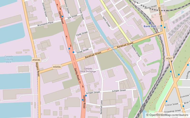
Quadrant Park also known as the Quad or Quaddie was a nightclub in Bootle, UK opened during the late 1980s to the early 1990s. and one of the most important in the UK at the time. and was known to attract a number of international guest DJs. The main styles of music played were Italo house and acid house, retrospectively it could also be defined an early Superclub. ()
Coordinates: 53°26'10"N, 2°59'35"W
Address
KirkdaleLiverpool
ContactAdd
Social media
Add
Getting there by public transportation
Public transportation stops near this location
- Bus
- Train
 Bus
Bus
- Calculate routeBank Hall 7 min walk
- Calculate routeSandhills 12 min walk
- Calculate routeKirkdale 15 min walk
- Calculate routeBootle Oriel Road 20 min walk
- Calculate routeBootle Bus Station 30 min walk
Day trips


Frequently Asked Questions (FAQ)
Which popular attractions are close to Quadrant Park?
Nearby attractions include Statue of Edward VII, Liverpool (16 min walk), St John the Evangelist's Church, Liverpool (16 min walk), Bootle War Memorial, Liverpool (16 min walk), Bootle Town Hall, Liverpool (17 min walk).
How to get to Quadrant Park by public transport?
The nearest stations to Quadrant Park:
Train
Bus
Train
- Bank Hall (7 min walk)
- Sandhills (12 min walk)
Bus
- Bootle Bus Station (30 min walk)