Braidfauld, Glasgow
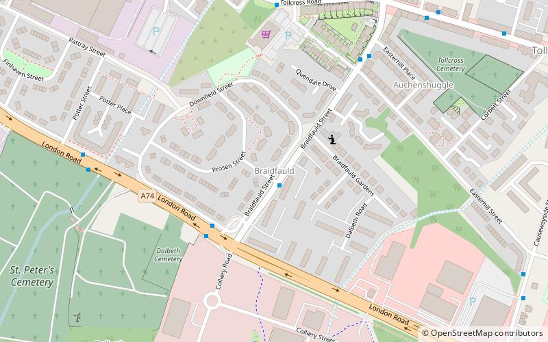
Map
Facts and practical information
Braidfauld is a small area of Glasgow, Scotland which is in the East End of the city slightly north of the River Clyde and south of the Tollcross area. It was also the name of the 45th ward of Glasgow City Council, prior to the re-organisation into multi-member wards in 2007. ()
Coordinates: 55°50'28"N, 4°10'46"W
Address
BraidfauldGlasgow
ContactAdd
Social media
Add
Getting there by public transportation
Public transportation stops near this location
- Bus
- Train
 Bus
Bus
- Calculate routeTollcross, Tollcross Road/ Wellshot Road 9 min walk
- Calculate routeCarntyne 25 min walk
- Calculate routeCarmyle 25 min walk
- Calculate routeShettleston 30 min walk
Day trips


Frequently Asked Questions (FAQ)
Which popular attractions are close to Braidfauld?
Nearby attractions include Auchenshuggle, Glasgow (6 min walk), Tollcross, Glasgow (9 min walk), Auchenshuggle Bridge, Glasgow (10 min walk), Clydebridge Steelworks, Glasgow (18 min walk).
How to get to Braidfauld by public transport?
The nearest stations to Braidfauld:
Bus
Train
Bus
- Tollcross, Tollcross Road/ Wellshot Road • Lines: 61 (9 min walk)
Train
- Carntyne (25 min walk)
- Carmyle (25 min walk)