Bleaberry Fell, Keswick

Gallery (1)
Map
Map
Facts and practical information
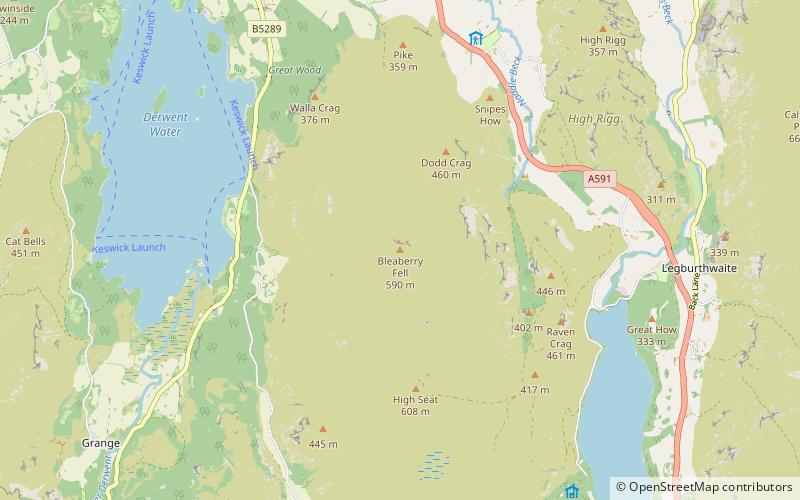
Bleaberry Fell is a fell in the Lake District in Cumbria, England, with a height of 590 metres. It stands on the main watershed between Borrowdale and Thirlmere and can be climbed from either flank. Walla Crag is a subsidiary top of Bleaberry Fell. ()
Coordinates: 54°33'59"N, 3°6'23"W
Address
Keswick
ContactAdd
Social media
Add
Getting there by public transportation
Public transportation stops near this location
- Bus
 Bus
Bus
- Calculate routeShoulthwaite Farm 29 min walk
Day trips


Frequently Asked Questions (FAQ)
How to get to Bleaberry Fell by public transport?
The nearest stations to Bleaberry Fell:
Bus
Bus
- Shoulthwaite Farm • Lines: 555 (29 min walk)