Inkpen Crocus Field, Kintbury
#6 among attractions in Kintbury
![Inkpen Crocus Field location map](https://tzmedia.b-cdn.net/media/images/static-maps/gb/51_37381_-1_4703.jpg)
Facts and practical information
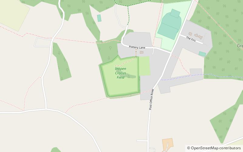
Inkpen Crocus Fields is a 3.1-hectare biological Site of Special Scientific Interest near Inkpen in Berkshire. It is managed by the Berkshire, Buckinghamshire and Oxfordshire Wildlife Trust. ()
Kintbury plan & book
Unleash the traveler in you — discover the cheapest flight deals, find the perfect hotel or hostel nearby, and search for the best car rental prices. Travel at your own pace to discover new places and enjoy your journey.
Inkpen Crocus Field – popular in the area (distance from the attraction)
Nearby attractions include: Wayfarer's Walk, Test Way, Dun Mill Lock, Hungerford Lock.
1.2 miSHiking, Hiking trailWayfarer's Walk
30 min walk • Nestled in the picturesque landscape of the United Kingdom, the Wayfarer's Walk is a haven for hiking enthusiasts and nature lovers alike. This enchanting hiking trail stretches over 70 miles, offering a magnificent journey through the rolling hills and verdant...
1.4 miSHiking, Hiking trailTest Way
36 min walk • The Test Way is a 44-mile long-distance footpath in England from Walbury Hill in West Berkshire to Eling in Hampshire, which follows much of the course of the River Test. The northern end of the footpath starts in the car park on Walbury Hill.
2.8 miNWCanalDun Mill Lock
73 min walk • Dun Mill Lock is a lock on the Kennet and Avon Canal, near Hungerford, Berkshire, England. The lock has a rise/fall of 5 ft 8 in. It is a grade II listed building.
3.6 miNWCanalHungerford Lock, Hungerford
92 min walk • Hungerford Lock is a lock on the Kennet and Avon Canal, at Hungerford, Berkshire, England. The lock has a rise/fall of 8 ft 0 in.
2.6 miNCanalWire Lock
66 min walk • Wire Lock is a lock on the Kennet and Avon Canal, near Hungerford, Berkshire, England. It is a grade II listed building.
1.5 miSForts and castlesWalbury Hill, Hungerford
38 min walk • Walbury Hill is a summit of the North Wessex Downs in Berkshire, England. At 297 metres above sea level, it is the highest natural point in South East England. Walbury Hill is the starting point for both the Test Way and the Wayfarer's Walk footpaths.
3 miSENature, Natural attraction, HillPilot Hill
76 min walk • Pilot Hill is the highest summit in Hampshire, England, with a maximum elevation of 286 m. Around 2 miles to the northwest is Walbury Hill, the county top of Berkshire, which is 297 m high.
3.2 miSEManor houseStargroves, Kintbury
81 min walk • Stargroves is a manor house and associated estate at East Woodhay in the English county of Hampshire. The house belonged to Mick Jagger during the 1970s and was a recording venue for the Rolling Stones and various other rock bands, as well as a filming location for Doctor Who.
3.2 miNECanalDreweatt's Lock
83 min walk • Dreweatt's Lock is a lock on the Kennet and Avon Canal, between Kintbury and Newbury, Berkshire, England. The lock has a rise/fall of 5 ft 9 in. It is a grade II listed building.
2.9 miNEForestIrish Hill Copse, Kintbury
74 min walk • Irish Hill Copse is a 15.9-hectare biological Site of Special Scientific Interest east of Kintbury in Berkshire. This site of coppiced ancient woodland includes an extensive area of calcareous ash/wych elm coppice on the hill sides, merging into wet ash/maple and acid oak/ash/hazel woodland with aspen, on the higher parts of the site.
3.4 miNWLibraryHungerford Library, Hungerford
88 min walk • Hungerford Town Hall is a municipal building in the High Street, Hungerford, Berkshire, England. The town hall, which is the meeting place of Hungerford Town Council, is a Grade II listed building.