Guessens, Ayot St Lawrence
Map
Facts and practical information
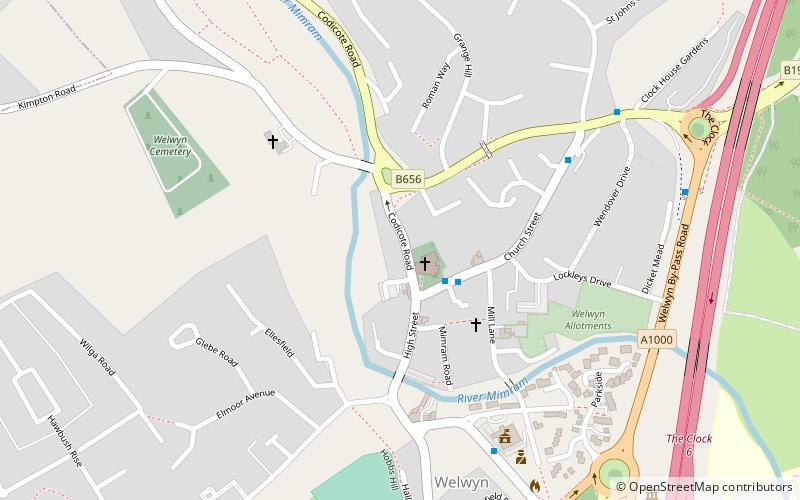
Guessens is a Grade II* listed timber-framed house at 6 Codicote Road, Welwyn, in Hertfordshire, England. It was built in the early 17th century and has later additions. From 1730 to 1765 it was the residence of the poet and dramatist Edward Young, who was also rector of Welwyn. ()
Coordinates: 51°49'54"N, 0°12'56"W
Address
Ayot St Lawrence
ContactAdd
Social media
Add
Getting there by public transportation
Public transportation stops near this location
- Bus
- Train
 Bus
Bus
- Calculate routeWelwyn North 30 min walk
- Calculate routeDigswell Road 33 min walk
- Calculate routeNursery Hill 39 min walk
Day trips
Guessens – popular in the area (distance from the attraction)
Nearby attractions include: Welwyn Roman Baths, Digswell Viaduct, Lockleys Roman Villa, The Frythe.


Frequently Asked Questions (FAQ)
Which popular attractions are close to Guessens?
Nearby attractions include Welwyn Roman Baths, Ayot St Lawrence (9 min walk), Singlers Marsh, Ayot St Lawrence (9 min walk), Danesbury Park, Ayot St Lawrence (10 min walk), Lockleys Roman Villa, Ayot St Lawrence (12 min walk).
How to get to Guessens by public transport?
The nearest stations to Guessens:
Train
Bus
Train
- Welwyn North (30 min walk)
Bus
- Digswell Road • Lines: 403 (33 min walk)
- Nursery Hill • Lines: 403 (39 min walk)