Watling Estate, Borehamwood
Map
Facts and practical information
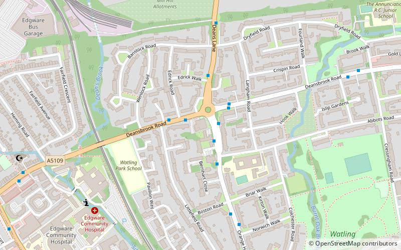
The Watling Estate is in Burnt Oak, in the Edgware district of the London Borough of Barnet. It was one of twelve London County Council cottage estates built between the wars to provide "homes fit for heroes". There are 4032 homes set in 386 acres. ()
Coordinates: 51°36'32"N, 0°15'58"W
Address
145 Orange Hill RoadBarnet (Burnt Oak)Borehamwood
Contact
+44 20 8959 2259
Social media
Add
Getting there by public transportation
Public transportation stops near this location
- Metro
- Bus
- Train
 Metro
Metro
- Calculate routeRuddock Close 1 min walk
- Calculate routeDeansbrook Close 2 min walk
- Calculate routeDeans Lane 2 min walk
- Calculate routeDeansbrook Road 3 min walk
- Calculate routeBurnt Oak 11 min walk
- Calculate routeEdgware 13 min walk
- Calculate routeColindale 30 min walk
- Calculate routeQueensbury 34 min walk
- Calculate routeMill Hill Broadway 20 min walk
Day trips


Frequently Asked Questions (FAQ)
Which popular attractions are close to Watling Estate?
Nearby attractions include Watling Park, London (8 min walk), John Keble Church, London (12 min walk), Mill Hill Old Railway Nature Reserve, London (13 min walk), St Margaret of Antioch, Borehamwood (15 min walk).
How to get to Watling Estate by public transport?
The nearest stations to Watling Estate:
Bus
Metro
Train
Bus
- Ruddock Close • Lines: 302 (1 min walk)
- Deansbrook Close • Lines: 303, 628, 642 (2 min walk)
Metro
- Burnt Oak • Lines: Northern (11 min walk)
- Edgware • Lines: Northern (13 min walk)
Train
- Mill Hill Broadway (20 min walk)