Dulwich Park, London
Map
Facts and practical information
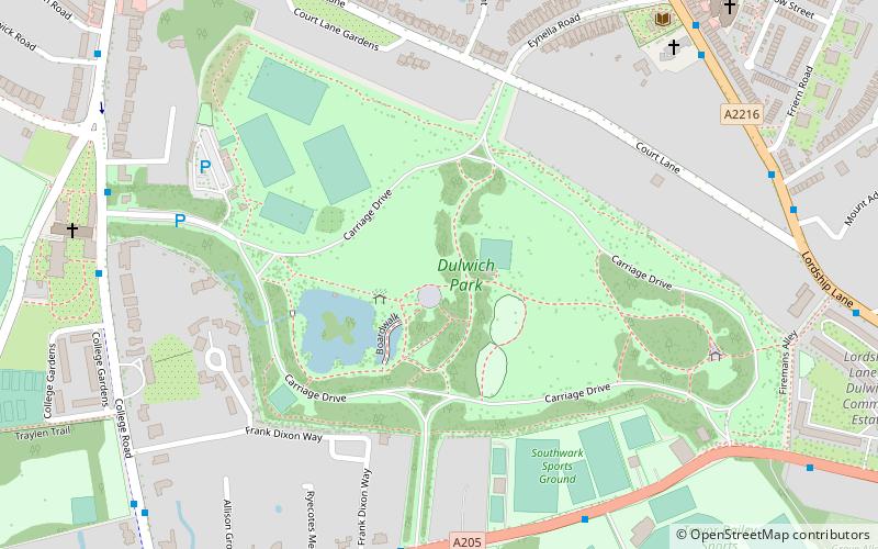
Dulwich Park is a 30.85-hectare public park in Dulwich in the London Borough of Southwark, south London, England. The park was created by the Metropolitan Board of Works from former farmland and meadows. While the initial design was by Charles Barry, it was later refined by Lt Col JJ Sexby. It was opened in 1890 by Lord Rosebery. From 2004 to 2006, the park was restored to its original Victorian layout, following a grant from the Heritage Lottery Fund. The park is listed Grade II on the Register of Historic Parks and Gardens. ()
Address
Southwark (Dulwich)London
ContactAdd
Social media
Add
Getting there by public transportation
Public transportation stops near this location
- Bus
- Train
 Bus
Bus
- Calculate routeDulwich Park / Queen Mary's Gate 6 min walk
- Calculate routeSouthwark Sports Ground 7 min walk
- Calculate routeDulwich Picture Gallery 8 min walk
- Calculate routeAllison Grove 8 min walk
- Calculate routeWest Dulwich 17 min walk
- Calculate routeNorth Dulwich 19 min walk
- Calculate routeSydenham Hill 24 min walk
- Calculate routeEast Dulwich 28 min walk
Maps Tube
Tube
TubeDay trips


Frequently Asked Questions (FAQ)
Which popular attractions are close to Dulwich Park?
Nearby attractions include Dulwich, London (2 min walk), College of God's Gift, London (8 min walk), Dulwich Picture Gallery, London (8 min walk), London Borough of Southwark, London (9 min walk).
How to get to Dulwich Park by public transport?
The nearest stations to Dulwich Park:
Bus
Train
Bus
- Dulwich Park / Queen Mary's Gate • Lines: P13, P4 (6 min walk)
- Southwark Sports Ground • Lines: P13, P4 (7 min walk)
Train
- West Dulwich (17 min walk)
- North Dulwich (19 min walk)