Rubicon Peak, Lake Tahoe Basin Management Unit
#21 among attractions in Lake Tahoe Basin Management Unit


Facts and practical information
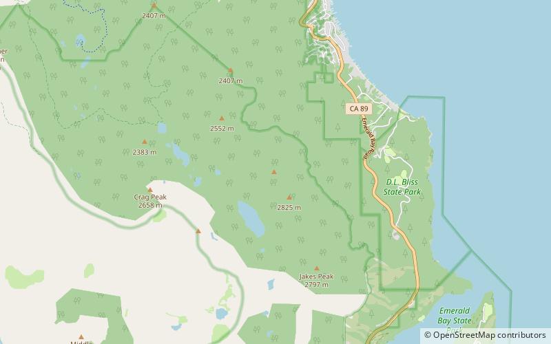
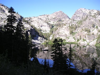
Rubicon Peak is a mountain in the Sierra Nevada mountain range to the west of Lake Tahoe in the Desolation Wilderness in El Dorado County, California. ()
Lake Tahoe Basin Management Unit United States
Rubicon Peak – popular in the area (distance from the attraction)
Nearby attractions include: Vikingsholm, Eagle Lake, Eagle Falls trailhead, Fallen Leaf Lake.
 Museum, Forts and castles, Historical place
Vikingsholm, South Lake Tahoe
73 min walk • Vikingsholm is a 38-room mansion on the shore of Emerald Bay at Lake Tahoe, in El Dorado County, California, U.S. and on the National Register of Historic Places.
 Natural attraction, Lake, Body of water
Eagle Lake, Lake Tahoe Basin Management Unit
84 min walk • Eagle Lake is a backcountry lake in the Sierra Nevada mountain range, to the west of Lake Tahoe in the Desolation Wilderness. It can be reached by hiking west out of the Eagle Lake trailhead on HWY 89 at Emerald Bay State Park.
 Hiking trail, Hiking, Trail
Eagle Falls trailhead, South Lake Tahoe
70 min walk • The Eagle Falls trailhead or Eagle Lake trailhead is located in the El Dorado National Forest, in the Sierra Nevada, within Emerald Bay State Park, on the western shore of Lake Tahoe, California.
 Nature, Natural attraction, Lake
Fallen Leaf Lake, Lake Tahoe Basin Management Unit
155 min walk • Fallen Leaf Lake is a mountain lake located in El Dorado County, California, near the California–Nevada state border, about one mile south west of the much larger Lake Tahoe.
 Nature, Natural attraction, Mountain
Maggies Peaks, South Lake Tahoe
104 min walk • Maggies Peaks refers to a mountain in the Sierra Nevada mountain range, southwest of Lake Tahoe. There are two peaks on the mountain about 0.7 miles apart.
 Nature, Natural attraction, Mountain
Silver Peak, Lake Tahoe Basin Management Unit
164 min walk • Silver Peak is a mountain in the Sierra Nevada mountain range at the north end of the Crystal Mountains, to the east of Lake Tahoe. It is located in the Desolation Wilderness in El Dorado County, California.
 Nature, Natural attraction, Mountain
Phipps Peak, Lake Tahoe Basin Management Unit
65 min walk • Phipps Peak is a mountain in the Sierra Nevada to the west of Emerald Bay and Lake Tahoe; and to the east of Rockbound Valley and the Crystal Range. The peak is in El Dorado County, California and the Desolation Wilderness.
 Lighthouse, Vernacular architecture
Rubicon Point Light, Bliss State Park
54 min walk • The Rubicon Point Light is a small lighthouse on Lake Tahoe in California.
 Natural attraction, Protected area
Emerald Bay State Park, Lake Tahoe Basin Management Unit
82 min walk • Emerald Bay State Park is a state park of California in the United States, centered on Lake Tahoe's Emerald Bay, a National Natural Landmark.
 Natural attraction, Protected area
Desolation Wilderness, Lake Tahoe Basin Management Unit
131 min walk • The Desolation Wilderness is a 63,960-acre federally protected wilderness area in the Eldorado National Forest and Lake Tahoe Basin Management Unit, in El Dorado County, California. The crest of the Sierra Nevada runs through it, just west of Lake Tahoe.
 Nature, Natural attraction, Mountain
Red Peak, Lake Tahoe Basin Management Unit
164 min walk • Red Peak is a mountain in the Sierra Nevada mountain range at the north end of the Crystal Range, to the west of Lake Tahoe. It is located in the Desolation Wilderness in El Dorado County, California.
